Our trip started in Salt Lake City with Maria, Sonny and Jake Goldsmith. The goal was to visit national parks and other sites in the four states that are part of the four corners (Utah, Colorado, New Mexico and Arizona). In addition, we would end our trip visiting Las Vegas in Nevada. Flying into Salt Lake City is an adventure. The airport is surrounded by the Wasatch & Salt Lake Mountain ranges. To land, the pilot needs to fly very low over the mountains and make a very steep drop onto the runway. May seem a little daunting, but the beautiful scenery is very distracting.
Salt Lake City and the Salt Flats
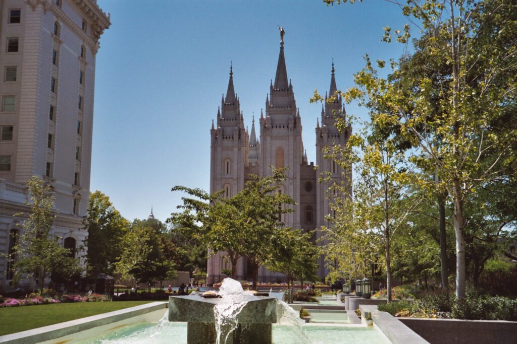
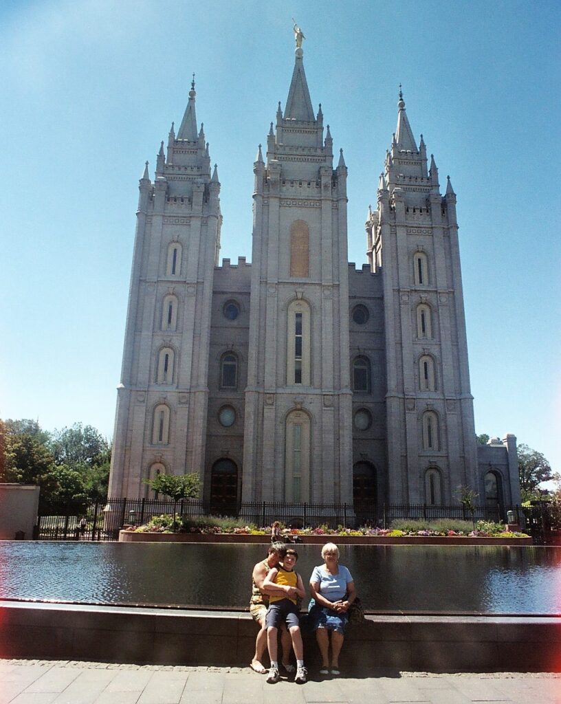
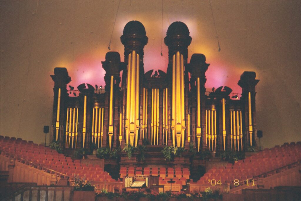
Salt is the central theme of this city. Its name comes from the high-salinity Great Salt Lake nearby. It is also the spiritual home of the Mormons, a Christian denomination whose idea of being “salt of the earth” has deeply touched lives. When we visited the Tabernacle they were playing organ music. Maria turned on her video recorder to capture the music (with no video). It was extremely quiet other than the music and then Jake chimes in with “Where are the numbers”. You can hear him loud and clear on the recording. His mom, slightly embarrassed, but also chuckling, as we all were, whispered there aren’t any honey, but the music will be over soon. Check out Jake, Our Godson to understand the significance of this question.
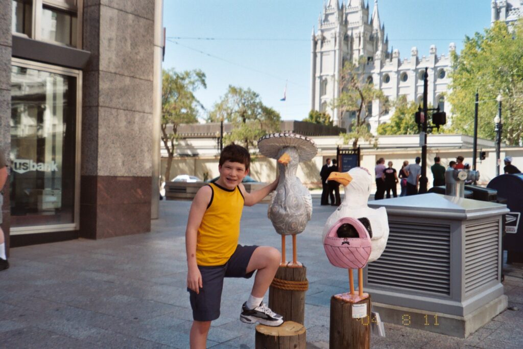
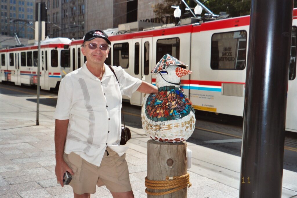
The Great Salt Lake is an oasis for migratory birds. Pelicans at the refuge have flown thousands of miles to reach the Great Salt Lake, where thousands of them will hatch chicks on desolate Gunnison Island, one of the species’ largest breeding colonies. In town, they paid tribute to these birds with many statues of the white pelican. This was the first city where we saw these types of statues. Soon after, Saratoga Springs did the same with horse statues and then ballet slippers.


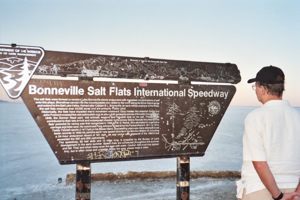
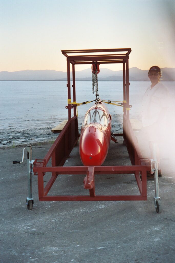
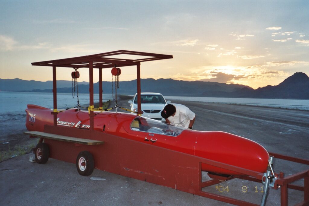
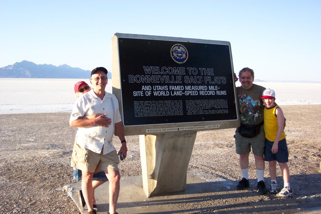
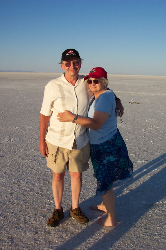
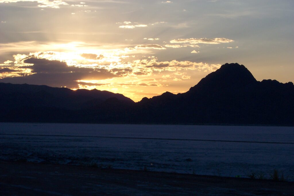
The Salt Lake Flats, known to many as Bonneville Salt Flats, are about 12 miles long and 5 miles wide and are comprised mostly of sodium chloride, or table salt., This forms a crust on the top of the lake that is so thick you can walk on it and cars can drive on it. This is where many land speed records have been set. Most daredevil racers and filmmakers have at one point tested their skills on these flats.
There is a road you can take to a point about 3 miles onto the flats. We drove to the end and took in the vast sight of the salt lake all around us. Except for mountains on the left, you see only vast whiteness. This is one spot on earth where you can see the curvature of the earth due the the distance of emptiness in front of you. On the way back, Sonny was driving and we encouraged him to drive onto the salt flats. He moved slightly off the road (getting 3 tires at one point on the salt). He quickly bounced back onto the road. We asked him why and he said “the salt felt slightly soft and I didn’t want to get stuck. We all teased him all the way back, until we found out that If you get stuck, there is a hefty fine to get towed out (at the time about $600). We than thanked Sonny.
Salt Lake City Olympic Village
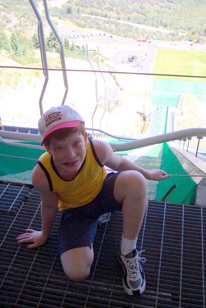
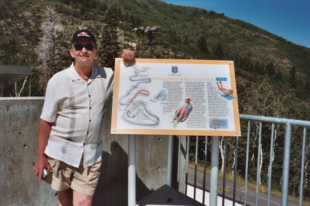
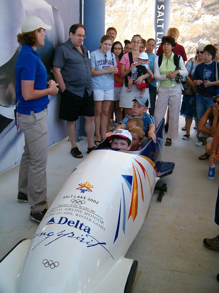
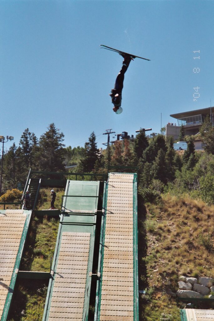
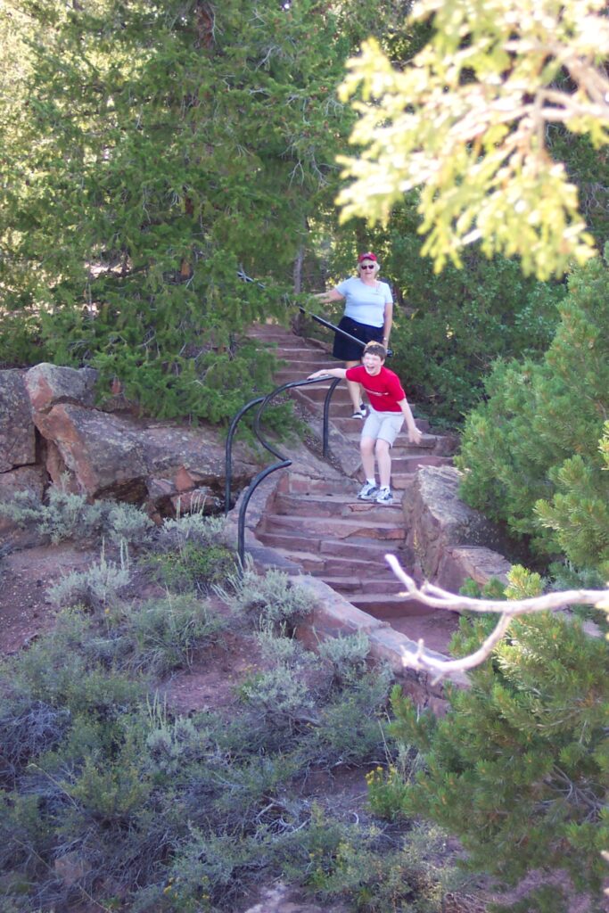
The Utah Olympic Park is a winter sports park, originally built to host ski jumping, Nordic combined, bobsled, skeleton and luge during the 2002 Olympic Winter Games in Salt Lake City. The park is a multi-use facility focused on developing and growing participation in winter sports in Utah and is an official United States Olympic training site. It is located in Summit County northwest of Park City, Utah. US ski jumpers train here in the summer, jumping into swimming pools. We were fortunate to catch some of them training. Also, many of the jumpers were young kids, as they start them very young because they have no fear. They did sell tickets to anyone that was brave enough for the adventure. Maria told me that she had thoughts of trying this herself, but was not dressed for it. Instead, she opted to have Jake do the zipline. He enjoyed it a lot and has since taken similar opportunities when he can.
We took a tour of the Olympic Park and got to see each of the facilities from the athlete’s perspective. The jumps look much higher from the top. Jake even got to sit in a bobsled.
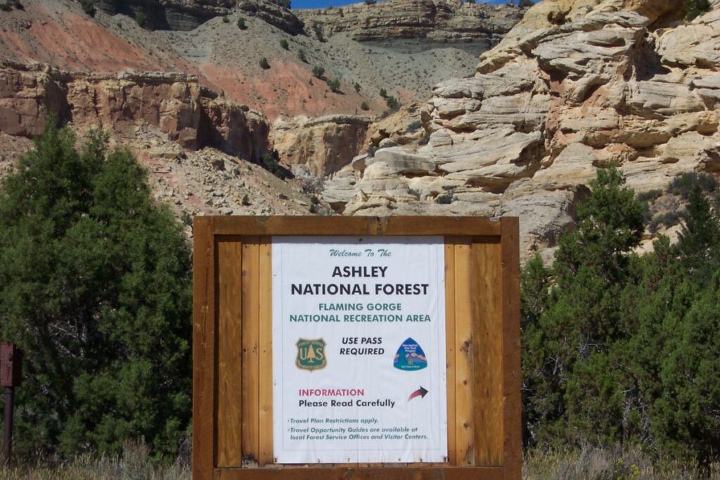
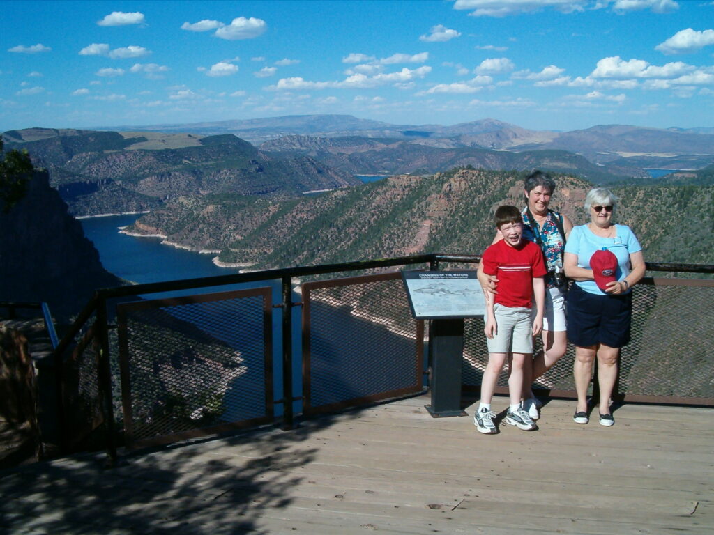
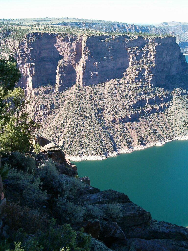
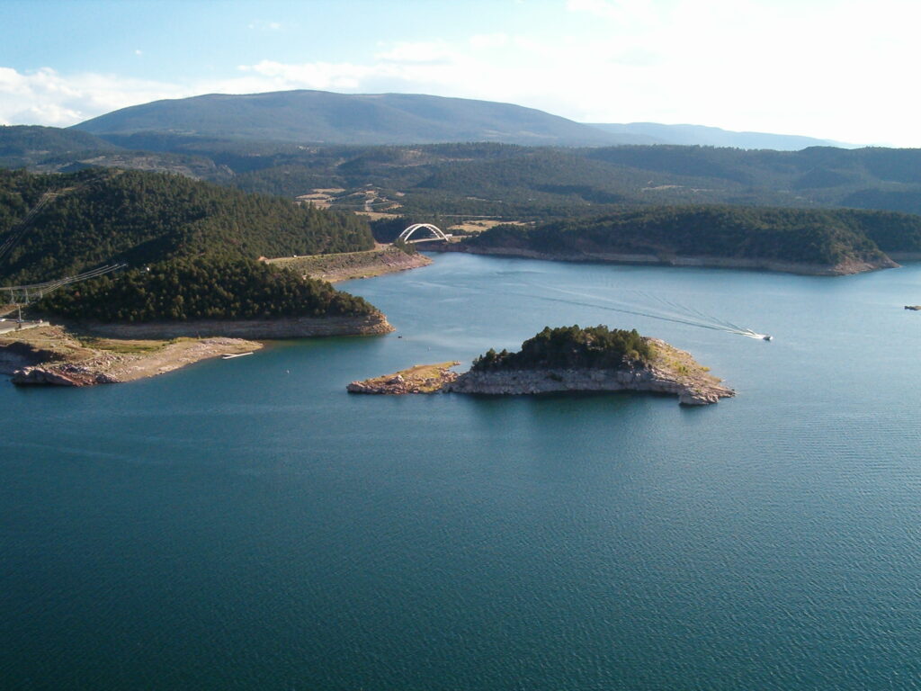
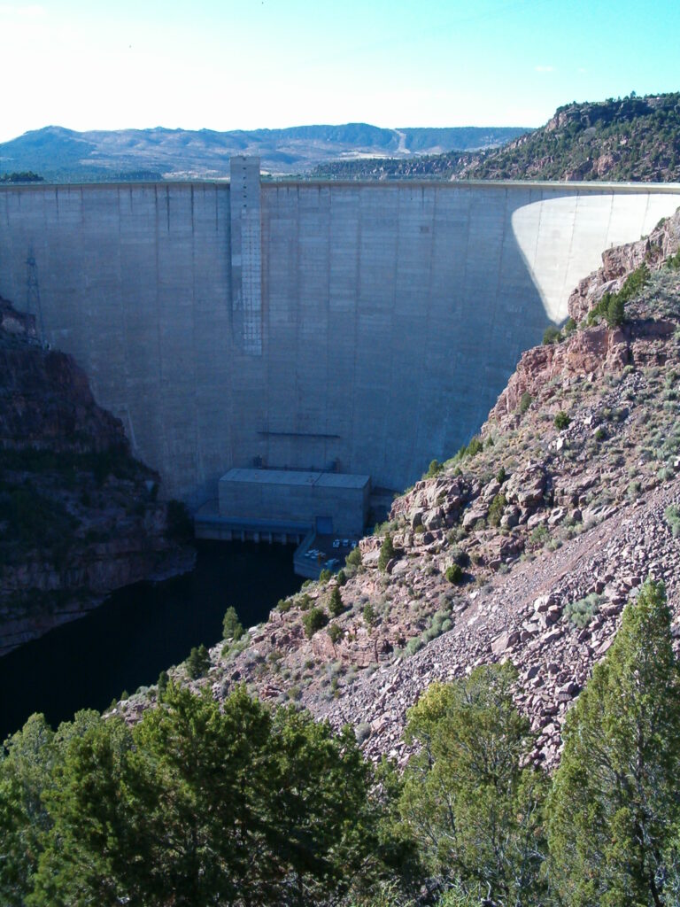
Flaming Gorge
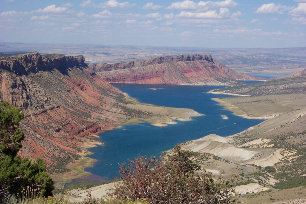
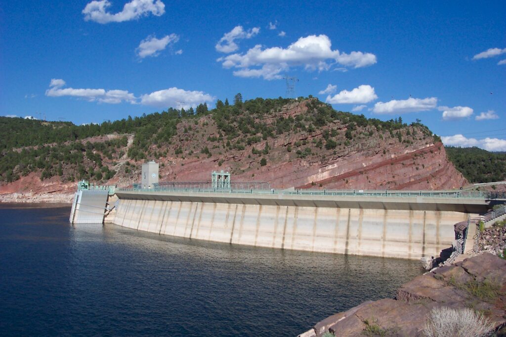
This wasn’t on our initial agenda, but Maria took us to the Flaming Gorge Reservoir, which she had visited on another trip to Salt Lake. It measures 91 miles long and spans the states of Wyoming and Utah. The Green River is separated from the reservoir by the towering wall of the Flaming Gorge Dam. The scenery was beautiful, and one of Mary’s favorite sights. It was just a glimpse into the scenery we would see during this trip.
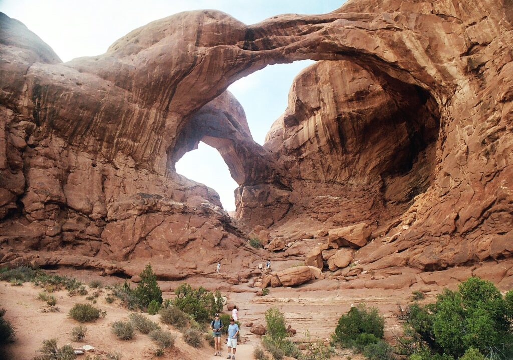
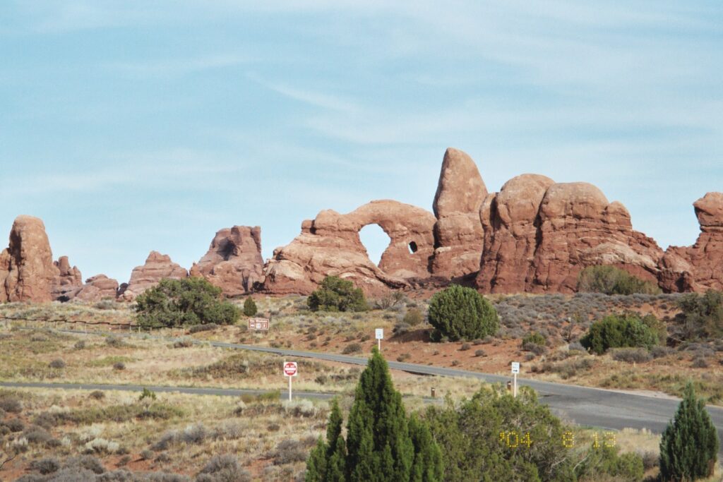
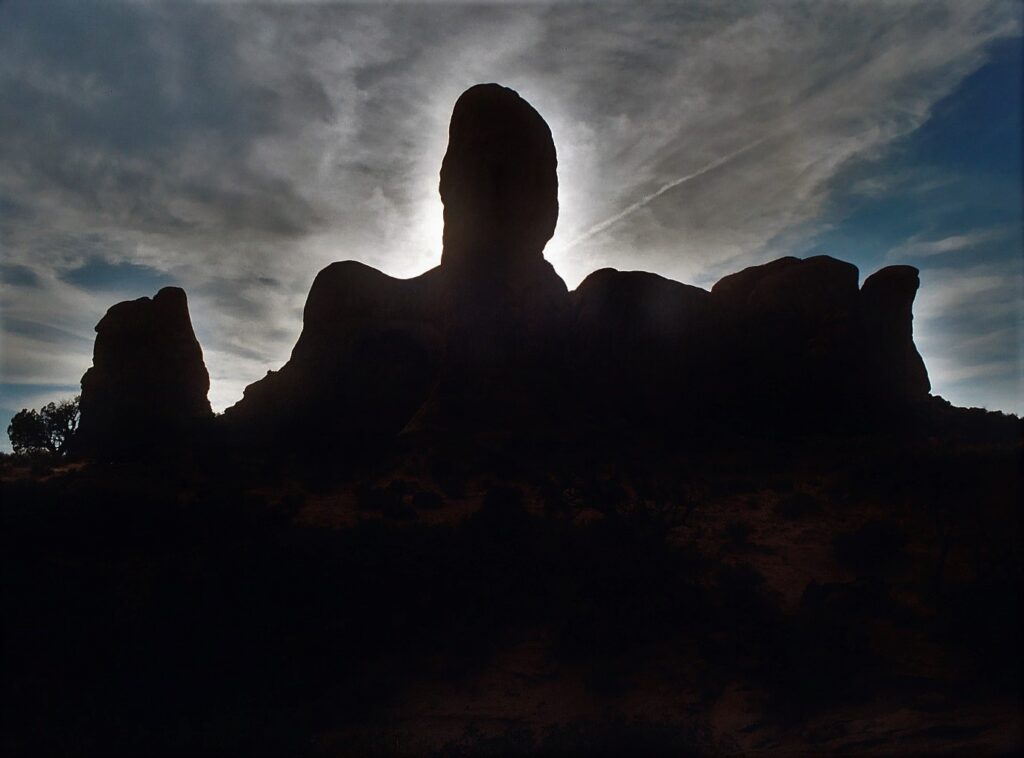
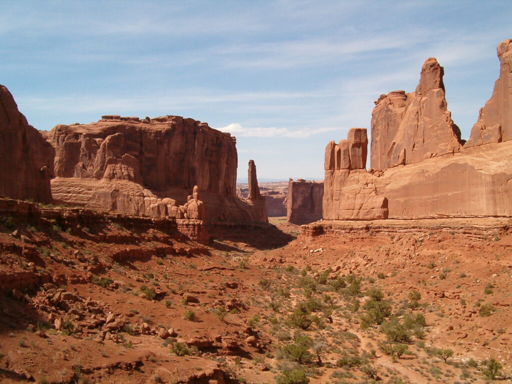
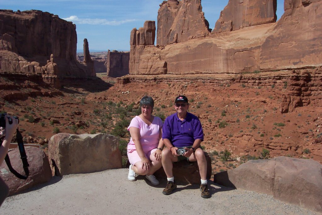
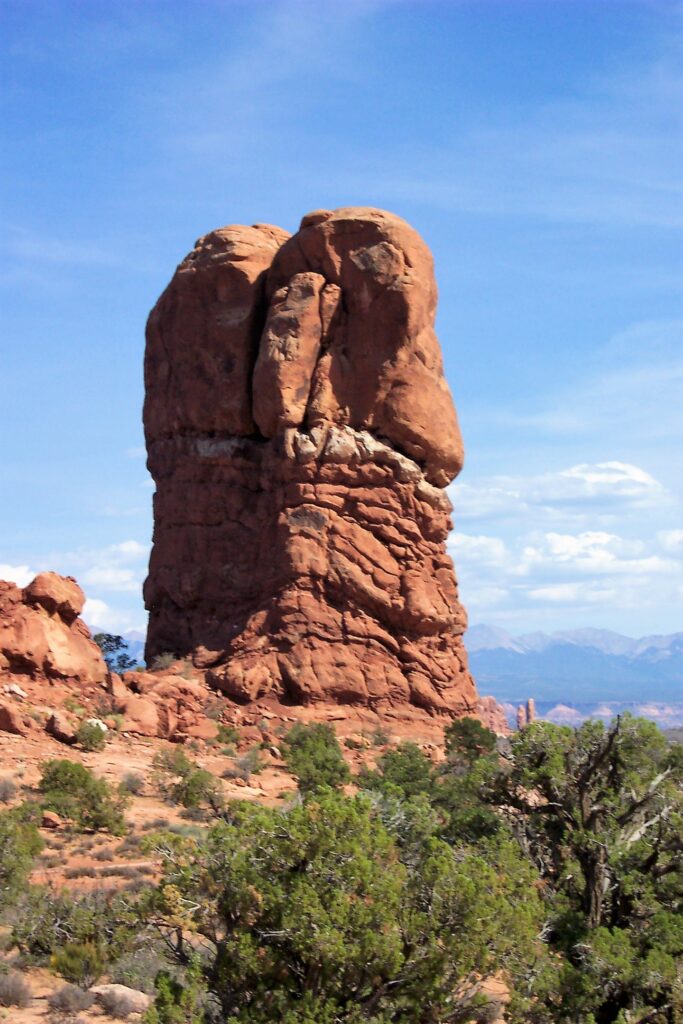
Arches National Park
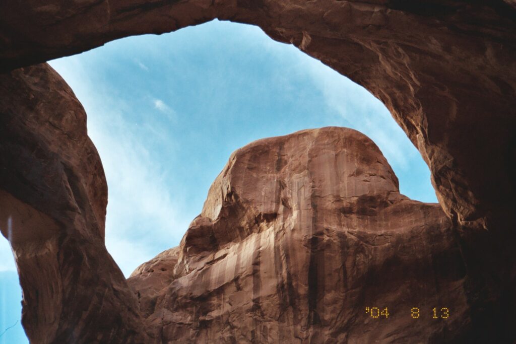
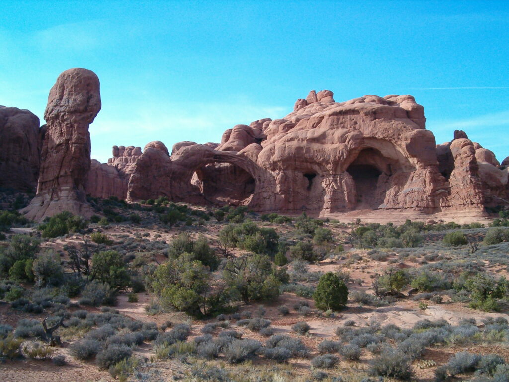
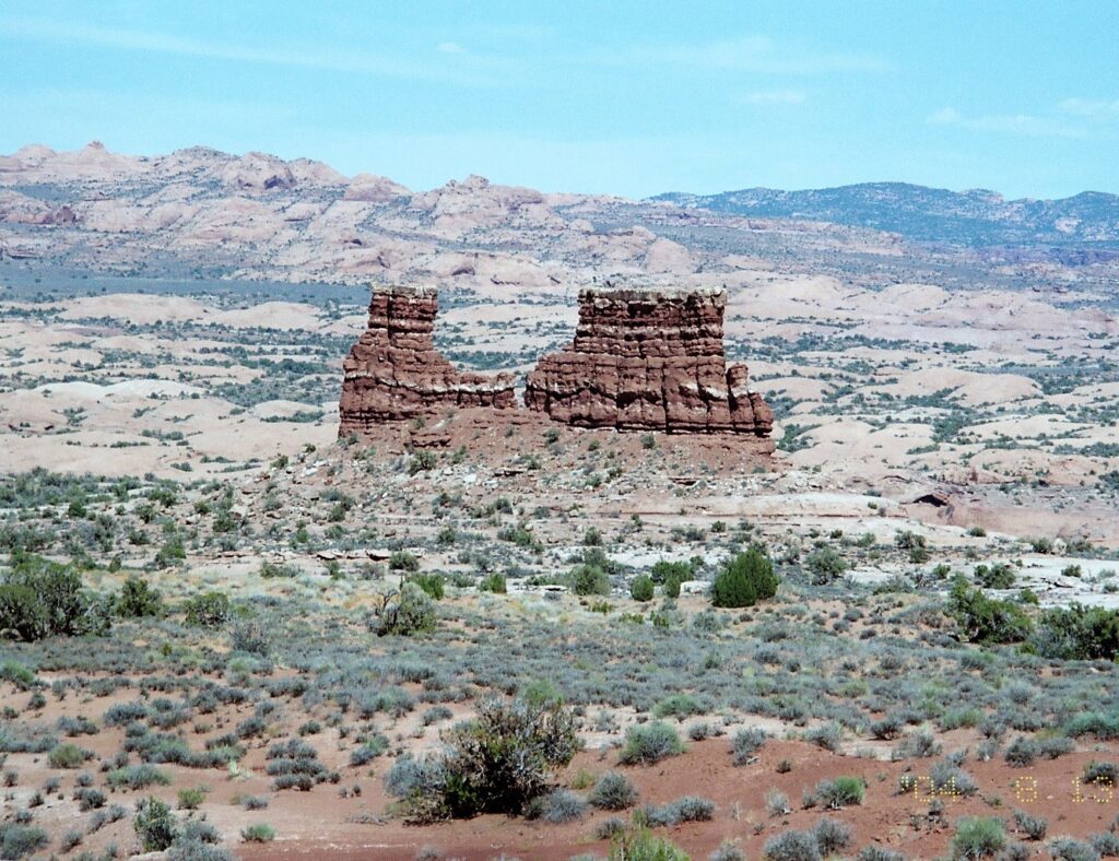
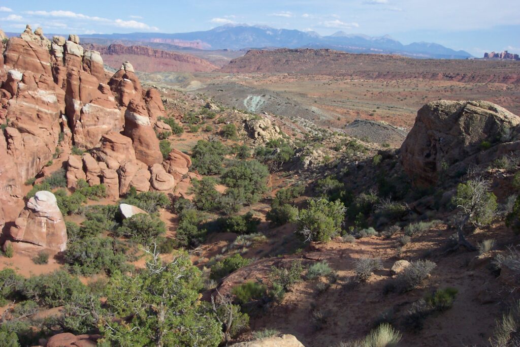
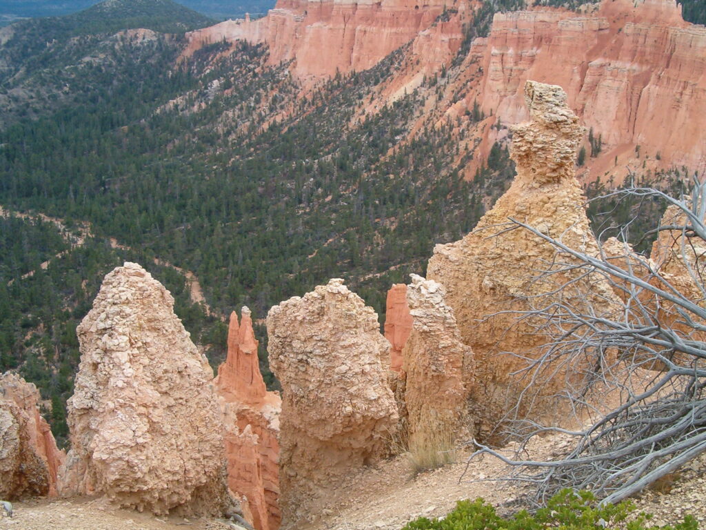
Arches National Park is best known for its sandstone geological formations, which have been changing slowly since the time of the dinosaurs and are still changing today. It is a 73,234-acre wonderland of eroded sandstone fins, towers, ribs, gargoyles, balanced rocks, and hoodoos (a tall, thin spire of rock formed by erosion). Bryce Canyon consists of many of these formations as you will see later, when we visited.
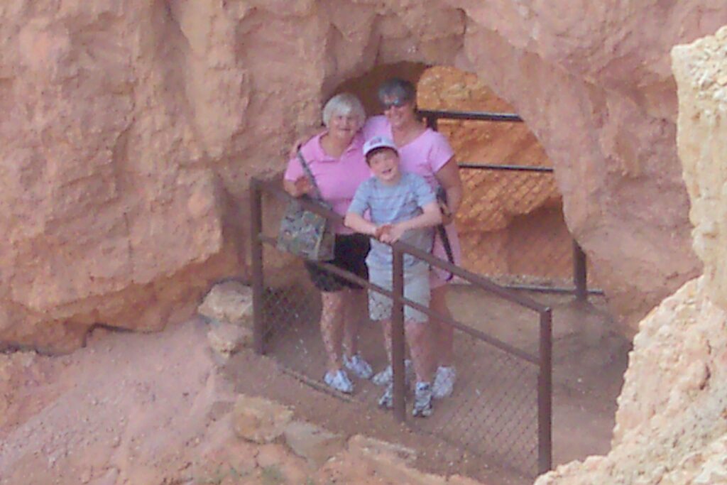
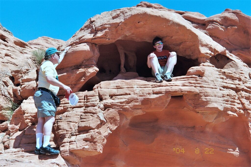
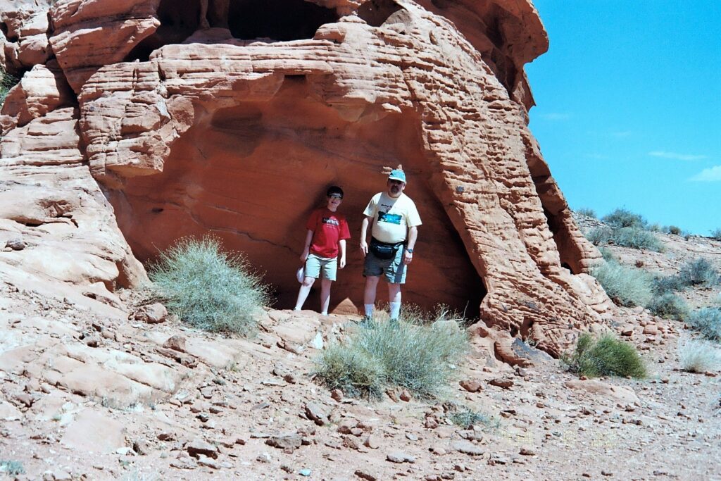
This is an amazing place and a testimony to nature in how these were formed over the thousands of years. We got to walk through and around many of the arches. The park requests that you not physically touch any of the rocks, as the oils from our skin can quicken the erosion. The Wall Arch, shown in the pictures below, collapsed during the night on August 4th, 2008. We were very fortunate to be able to experience this sight.
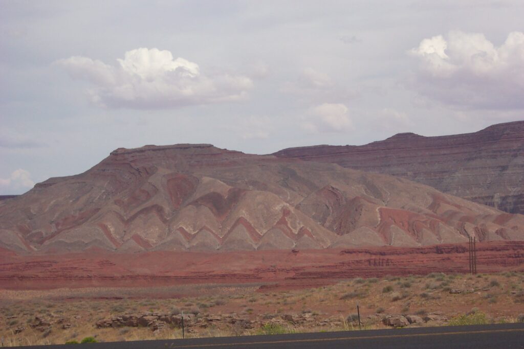
Million Dollar Road (Silverton to Ouray), Durango & San Juan River
We headed towards the Million Dollar Highway which travels between the small towns of Silverton and Ouray in Southwest Colorado. The highest point is 11,018 feet at the peak of Red Mountain Pass, in the San Juan Mountain Range.
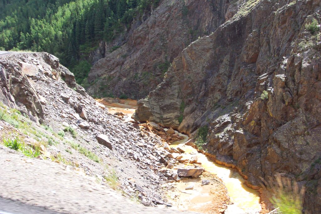

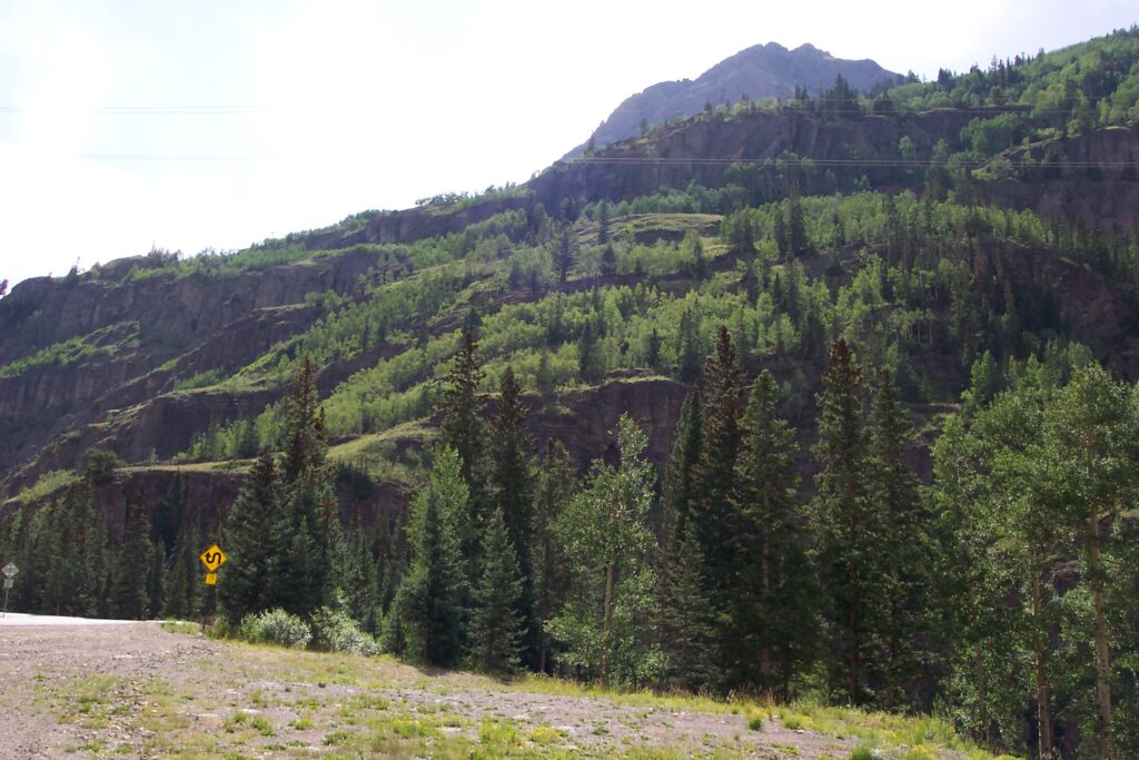
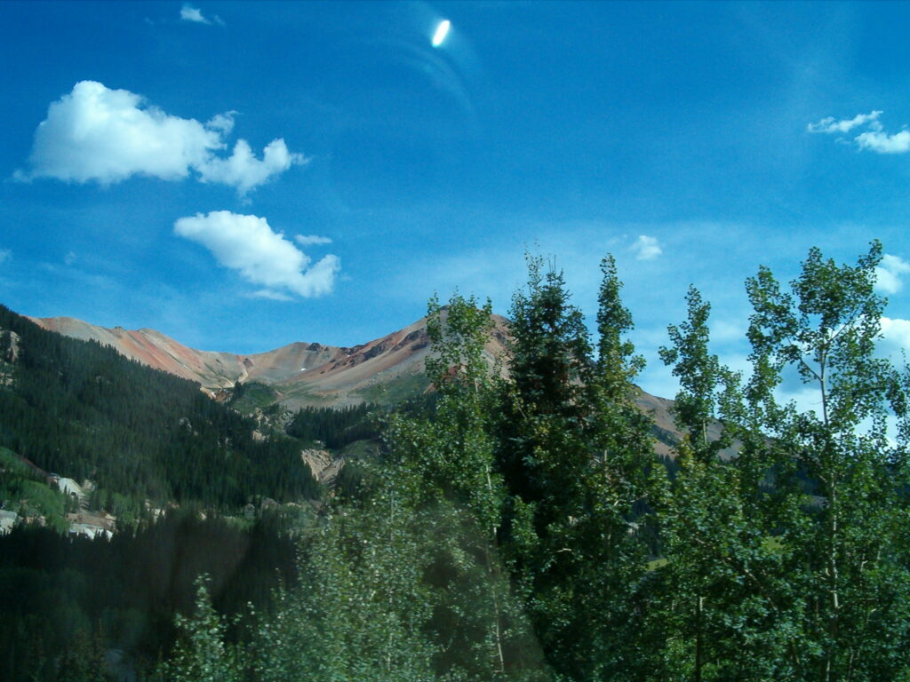
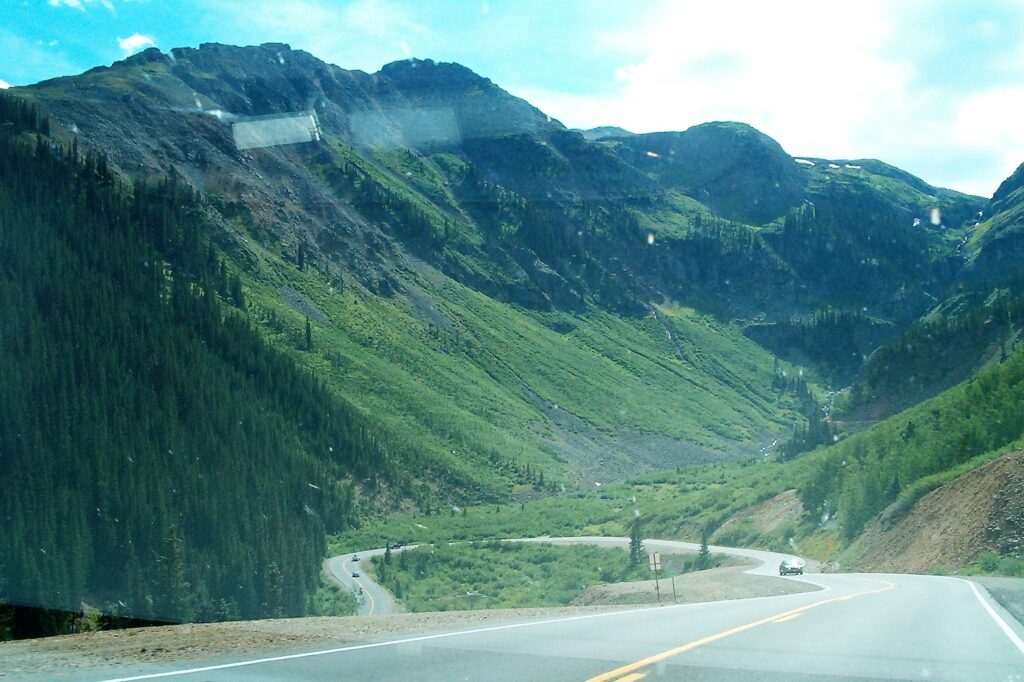
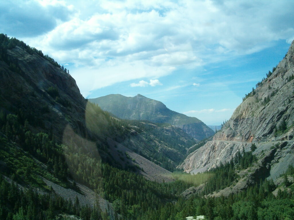
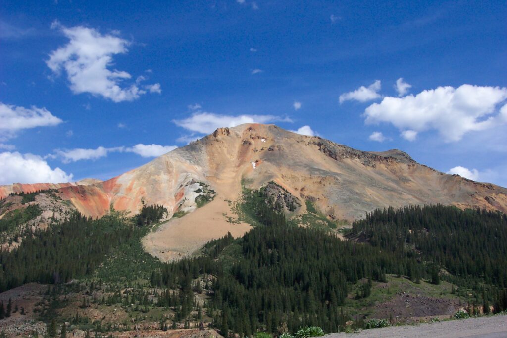
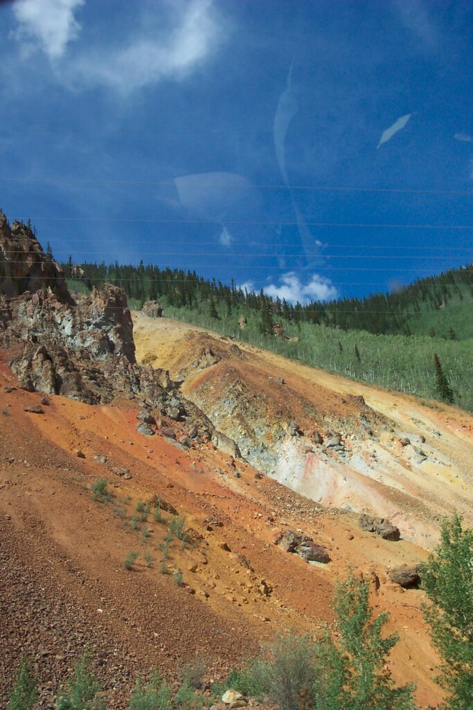
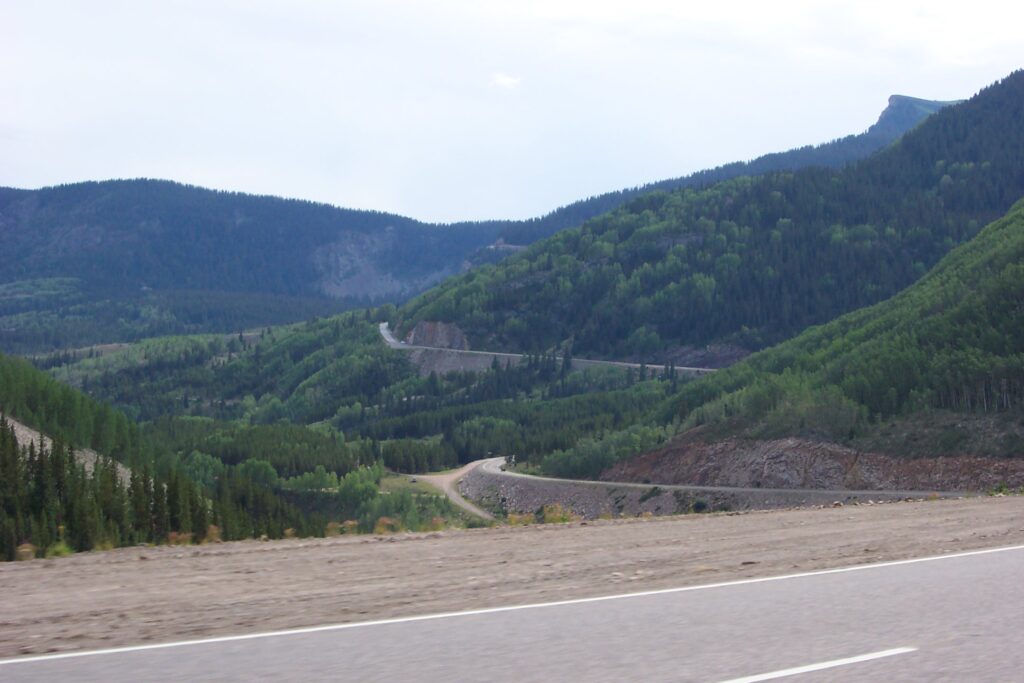
The Million Dollar Highway is a breathtaking scenic mountain pass that anyone traveling in Southwest Colorado must-see. This famous section of highway has breathtaking panoramas of steep, jagged mountains. Originally hand carved to transport ore to the railroad in the small town of Ouray, it was later widened and paved. There are several myths to how the highway earned its name. First one is from an entrepreneur named Otto Mears, who wanted to create a toll road through the mountains. He promised investors that they would make “a million dollars” if they invested in his project, hence the name “Million Dollar Highway”. The second one, people believed the construction must have taken a million dollars to build. Actually, it cost only $200,000.
It is said to be one of the most beautiful and dangerous roads (no guard rails) in the USA. The highway’s narrow lanes, sharp curves, and sheer drops make it dangerous for motorists. Why no guard rails, you may ask? It was built in the late 19th century, and its lack of guardrails is due to its construction on steep mountain terrain, so guardrails would be impractical to install given the rugged landscape. Additionally, installing guardrails could detract from the stunning views that travelers enjoy along this iconic road. This section is part of the greater San Juan Skyway, a 233-mile loop through some of the most iconic terrain in Southwest Colorado.
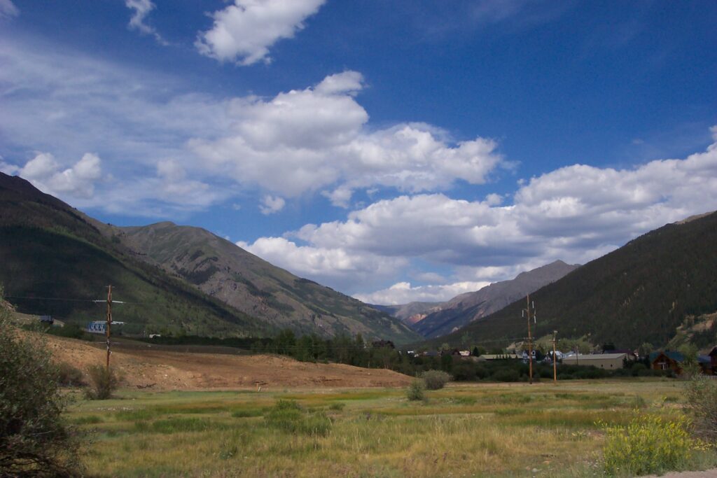
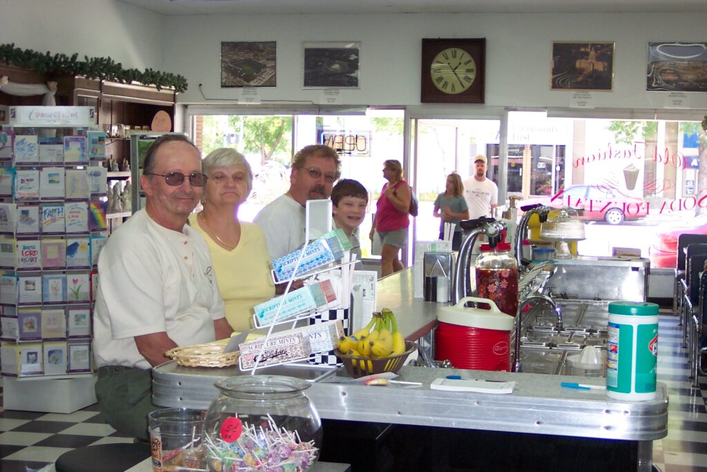
We stopped in Durango, a very nice western town near the New Mexico border. We found a store with a soda fountain. Of course we had to have ice cream. It was Jake’s first experience with a soda/ice cream shoppe. Durango is known for many things; massive mountains, unbeatable skiing and a historic narrow gauge railroad that runs from Silverton to Durango. This stills runs today as a scenic experience. We all stated we should do this someday. Add it to the list.
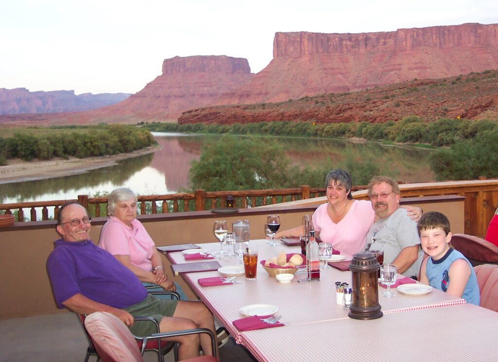
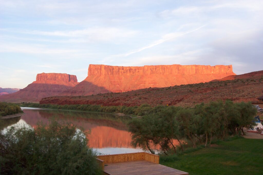
Afterwards, we traveled towards our time share in Pagosa Springs, Colorado. Along the way, we found a beautiful rustic restaurant which was right on the shore of the San Juan River. We had a delicious meal while watching the sun set on the sandstone rocks and river. Great end to a long and adventurous day.

Four Corners (Primarily in Farmington New Mexico)
The four states of Four Corners are: Utah, Colorado, New Mexico, and Arizona. It is called Four Corners because it is the only place where the borders of 4 states meet at one point. A simple cement pad marking the spot was installed in 1912. The monument was established in 1931. Over time, the monument evolved, with a granite marker bearing a copper disc established in 1992. People can stand on the center of this marker and declare they are standing in all 4 states at one time.
This is a National Monument, but unlike nearly all other National Park System units, the U.S. government does not own the land within the boundaries of the park. The park is administered by the Navajo Nation Parks and Recreation Department. Nearby, Native American artisans sell handmade jewelry, crafts and traditional foods from numerous booths and shops. The monument’s visitor center includes demonstrations and information about native cultures in the region.
There really isn’t a whole lot to do there, but we can say we did it and it inspired this entire trip.
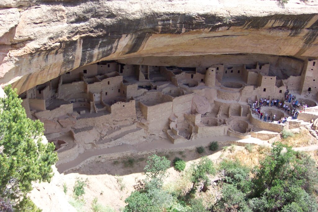
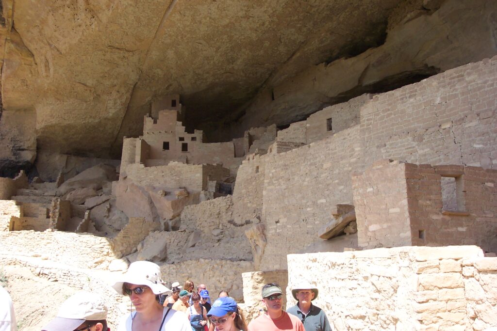
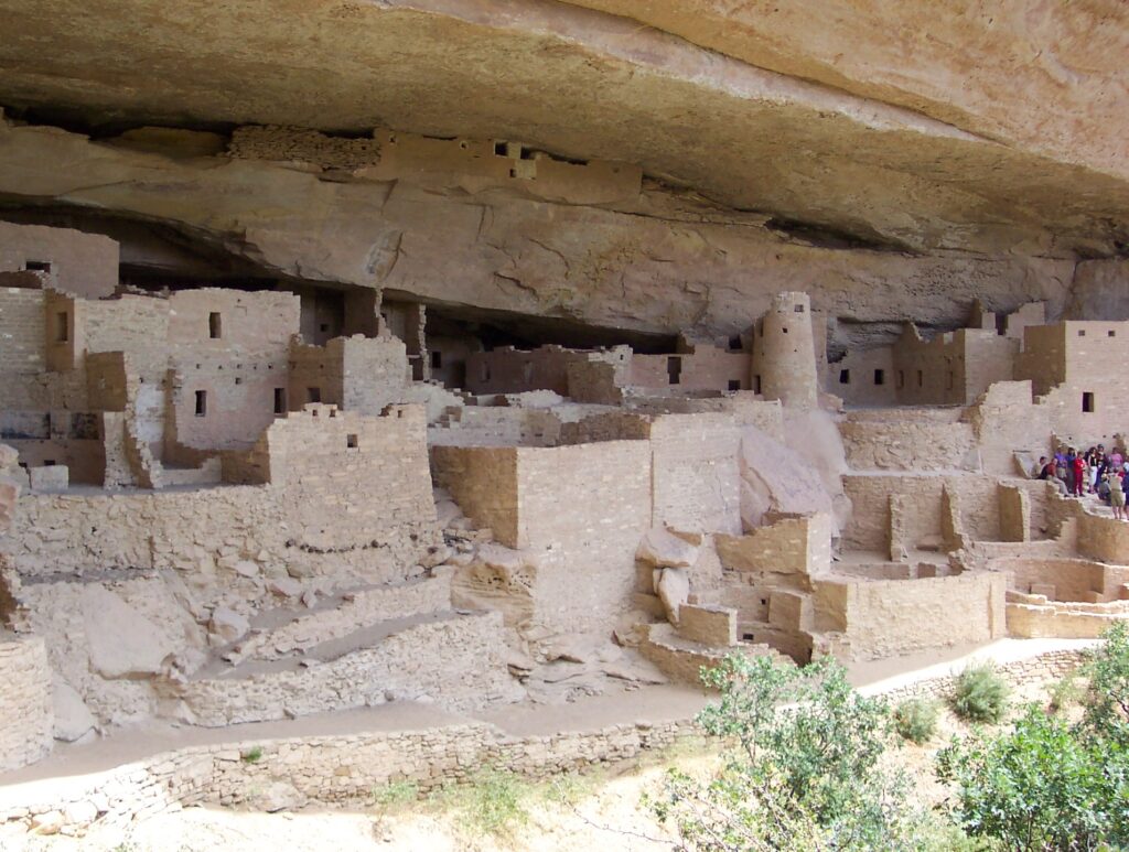
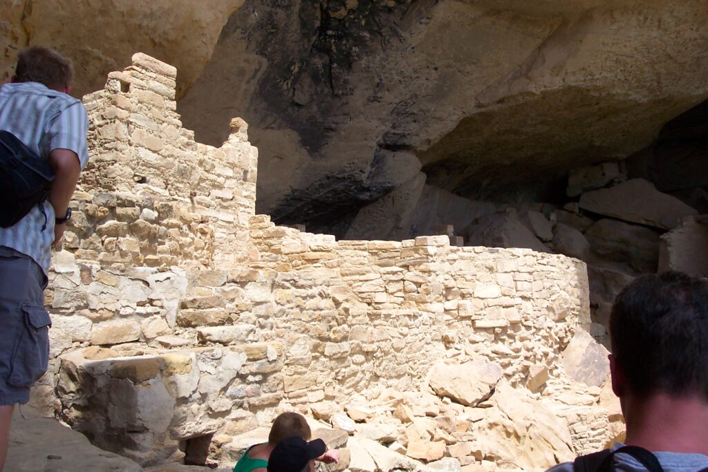
Mesa Verde, Colorado
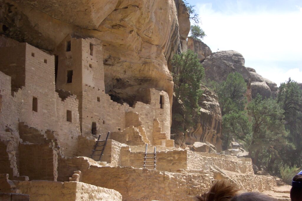
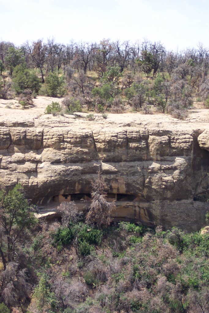
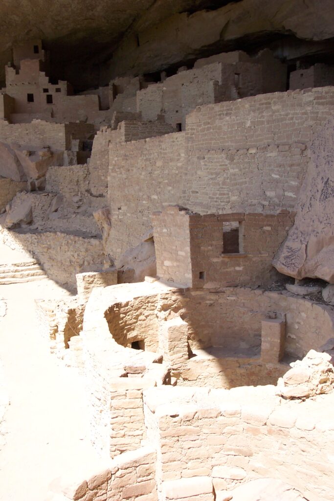
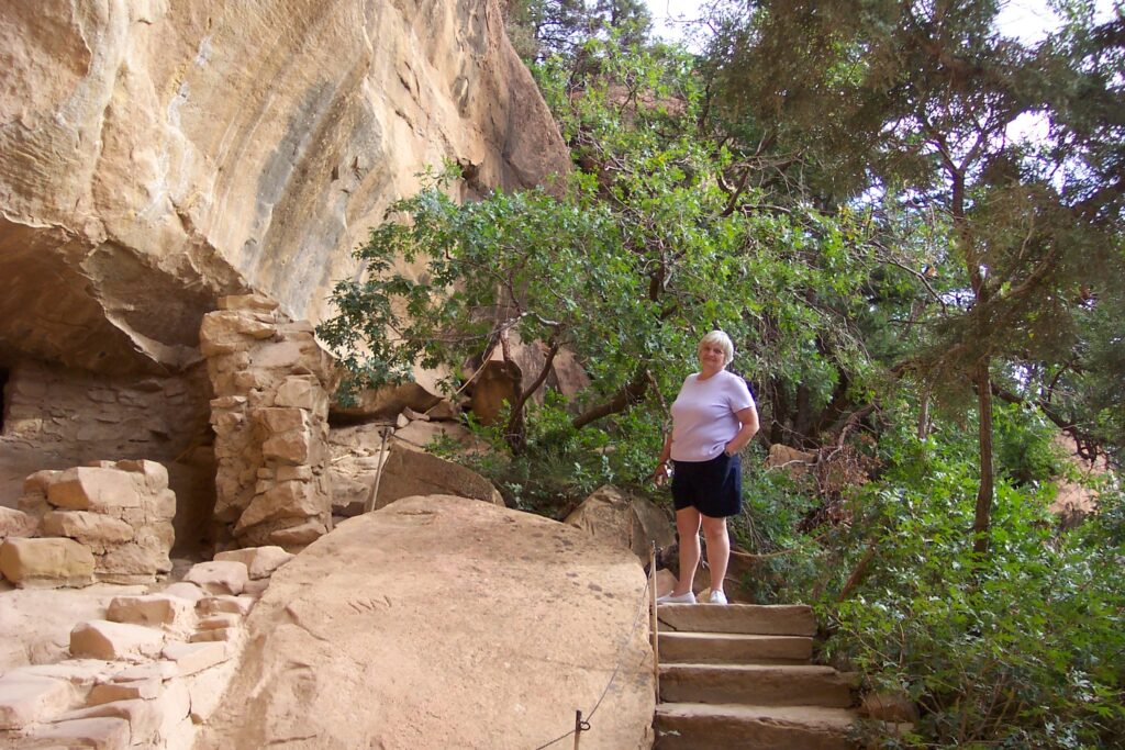
Mesa Verde is the historical home of the ancestral Pueblo Native people, who, over 700 years ago, built thriving communities on the mesas and in the cliffs. On top of the cliffs are the World Heritage Site and International Dark Sky Park, which are home to over a thousand species, including several that live nowhere else on earth. These includes butterflies, like the Kaibab Swallowtail, plants like the Chapin Mesa Milkvetch herb, owls like the Mexican spotted owl, and many other plants, insects and animals.
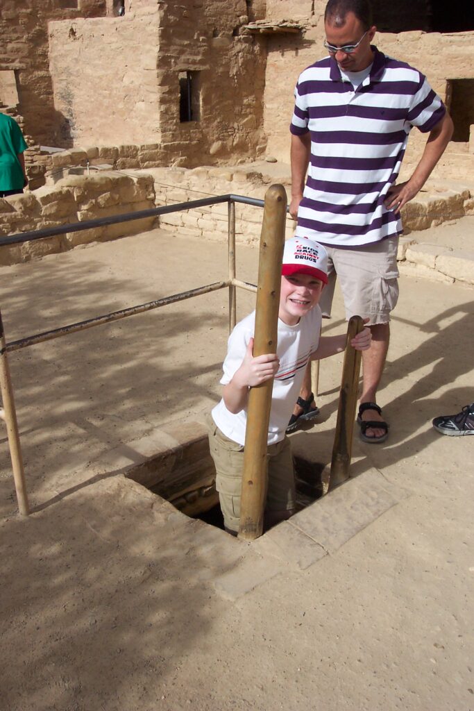
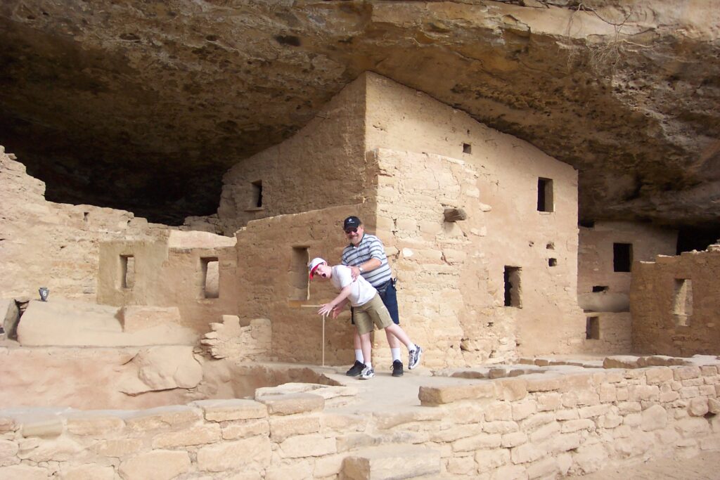
Below are pictures of the Cliff Palace dwellings. The pictures do not do them justice. They are very complex structures which contain unique living areas and kivas (rooms designated for religious rituals). Mary, Maria and Jake took a tour down into these dwellings. They said it was amazing to see the size, details and the numerous rooms that existed. Here is a virtual tour for your enjoyment. It is hard to visualize how they built these dwellings within the cliffs.
To exit the dwellings was a monumental task as you had to climb steep stone stairs and ladders in very tight quarters to get back to the mesa. Both Mary and Maria were anxious when they reached the top, as they each have a fear of tight spaces and it was quite a strenuous climb. Maria even commented “All she could think about was getting to the top so she could breathe”.
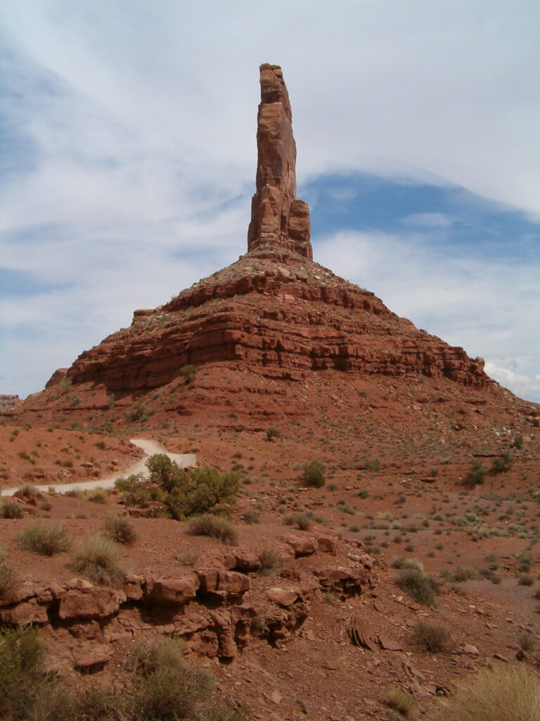
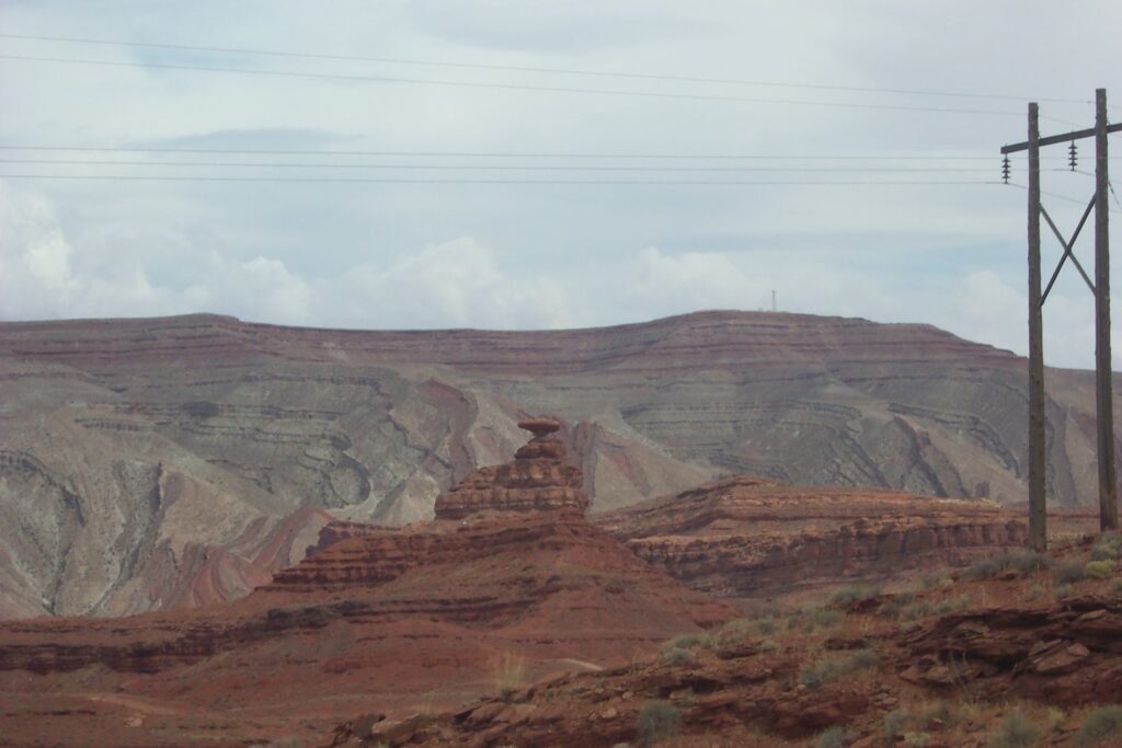
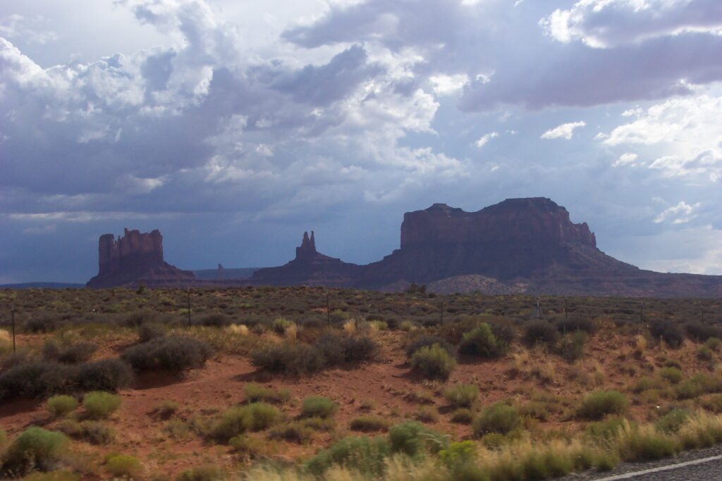
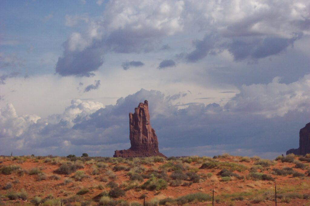
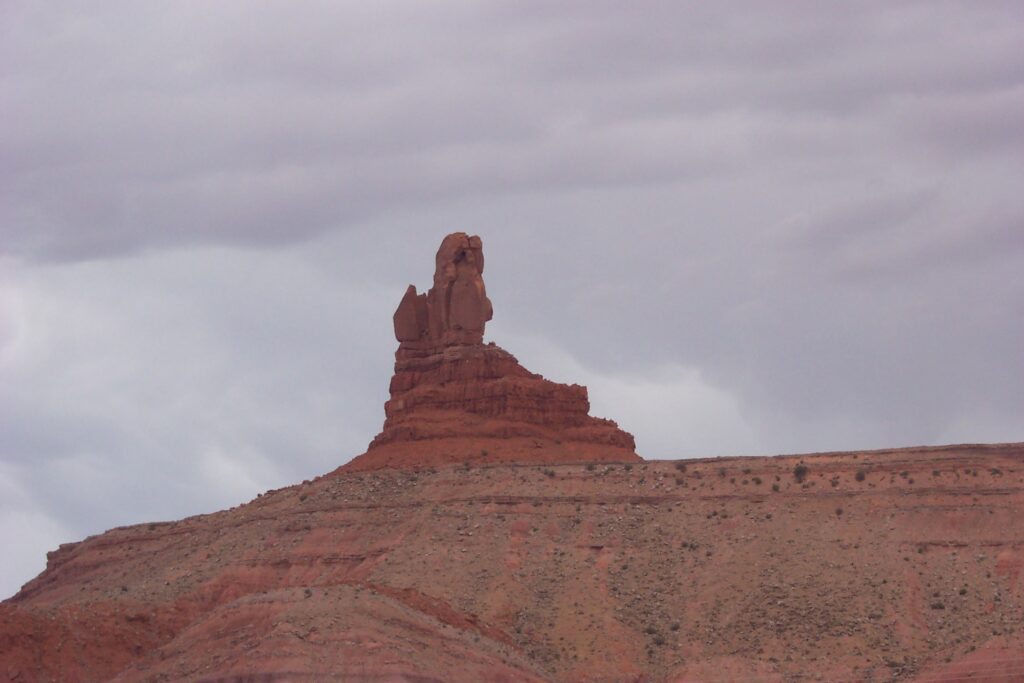
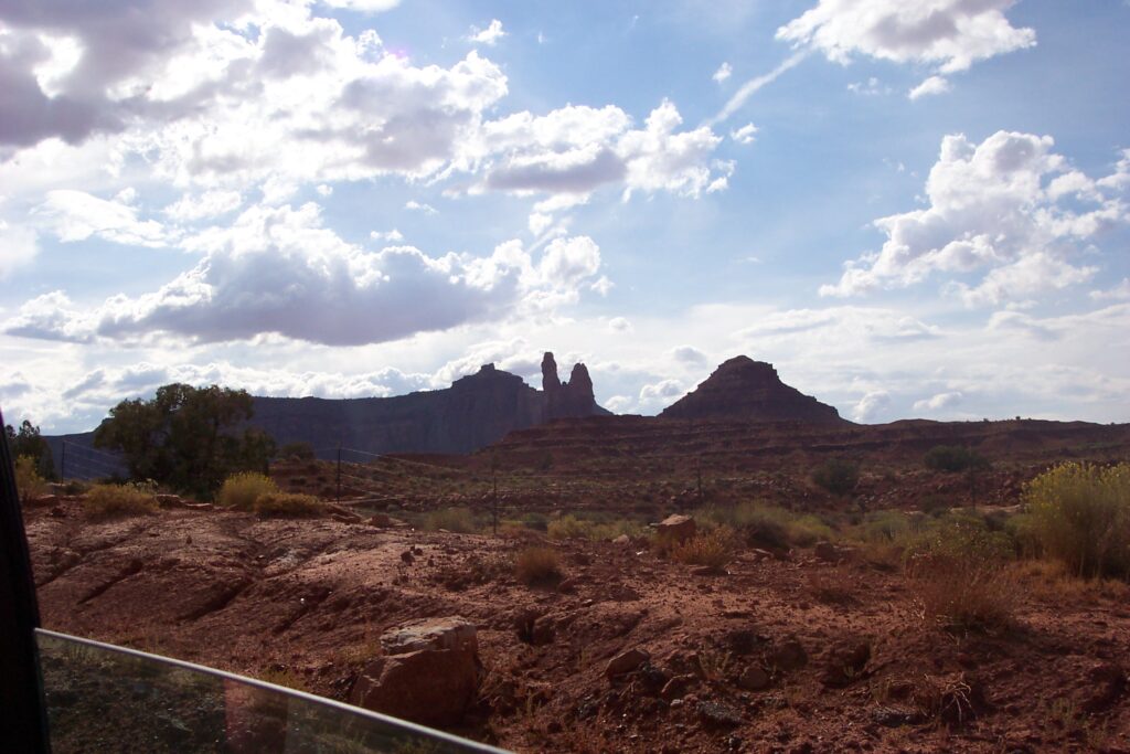
Monument Valley, Utah/Arizona
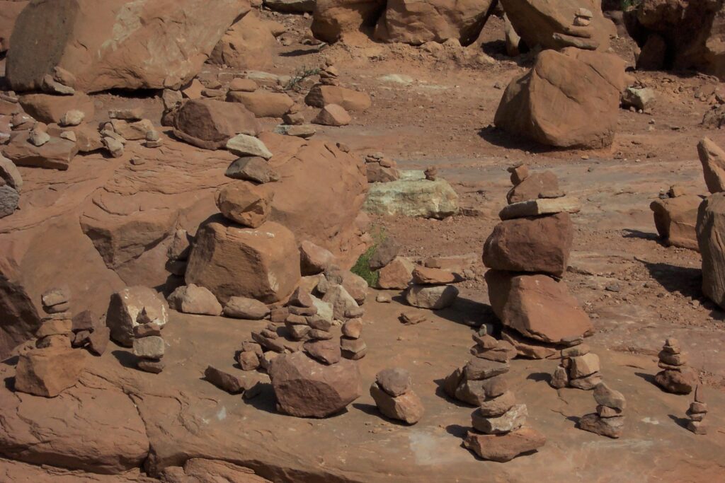
Monument Valley is a region of the Colorado Plateau and lies within the territory of the Navajo Nation Reservation and is considered a sacred area. It is characterized by a cluster of sandstone butte towers at heights from 400 to the largest reaching 1,000 feet above the valley floor. Located on the Utah-Arizona state line, it is near the Four Corners area. We drove the 17 mile dirt road through the flat desert landscape, which has some rocky terrain (glad we had a rental). We saw huge red monoliths and unique rock formations (cairns, a naturally occurring geological formation featuring a large rock or boulder, sometimes of substantial size, resting on other rocks, bedrock, or on glacial till) that jut out of the landscape, giving the valley its name. We stopped a few times to enjoy the sun reflecting off the buttes and casting shadows, providing great photography shots.
There is a section in the park where visitors can build their own cairn rock formations. The thing that amazed all of us was how respectful people were being to the other formations already built.
At one stop, there were people climbing. Jake wanted to do this and his parents nervously said ok. He climbed up the side to a fairly good height and was having a great time. However, when it was time to climb back down, he got frightened and froze. We talked him through it, telling him where to place each foot, and he did very well. He wanted to climb everything ever since (he became a Ninja).
Along the trail were a few Native road-side stands, where the Navajo sell their crafts. We picked up a few small things as souvenirs. We had a beautiful day, and the sun really highlighted its orange-red color. Hollywood filmed a lot in this area and most of John Wayne’s movies were made in this part of the world.
Route 66 in Arizona
U.S. Route 66 or U.S. Highway 66 was one of the original highways in the United States Numbered Highway System. It was established on November 11, 1926, with road signs erected the following year. Traveling this highway you will find examples and stories of a mobile nation on the road. There are more than 250 buildings, bridges, road alignments and other sites along Route 66 that are listed on the National Register of Historic Places. Being able to see some of these sites, takes us back in time to what traveling was like for our parents’ generation. The Goldsmiths and Ginzerys try to travel Route 66 wherever and whenever we can. We were fortunate to travel a small section of it as part of this trip as we traveled the Painted Desert and Petrified Forest trails.
Painted Desert & Petrified Forest, Arizona
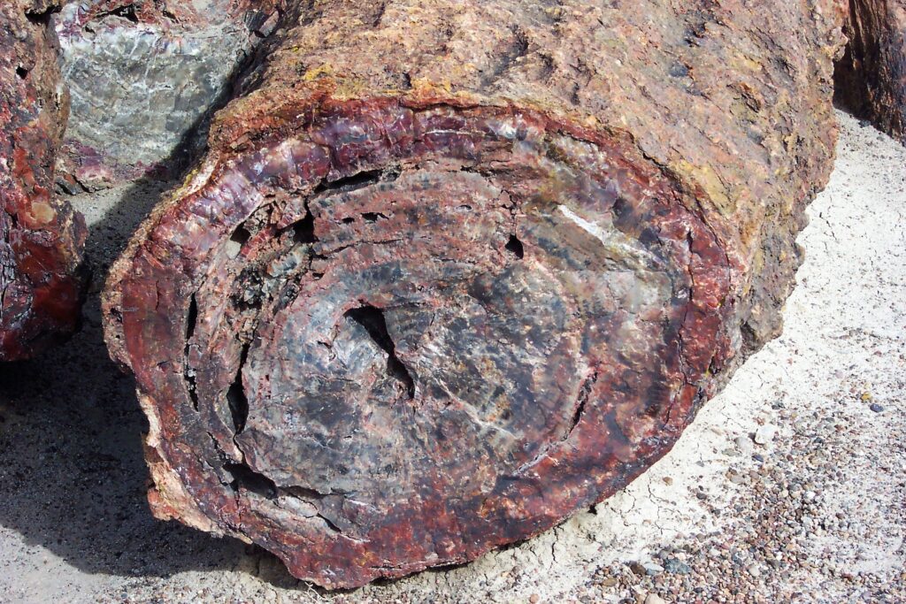
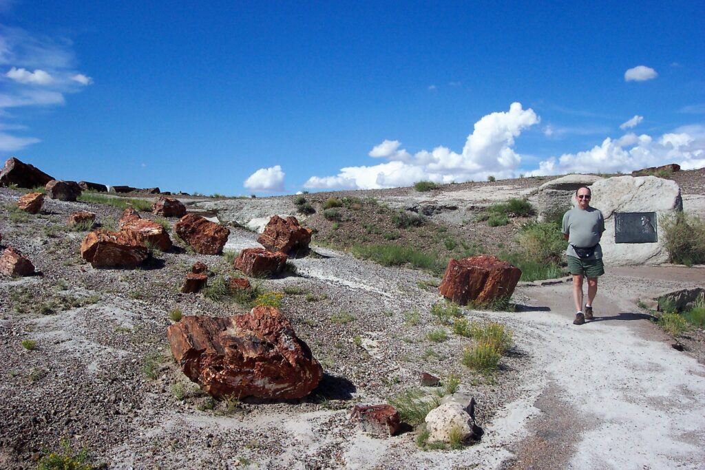
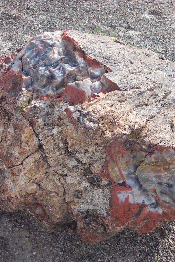
The Painted Desert and Petrified Forest National Park has the world’s largest and most colorful collection of petrified wood. It is also the only national park in the United States that protects a portion of Route 66.
The northern section of the park encompasses the Painted Desert—approximately 146 square miles of badlands and multihued mesas of stratified layers of mudstone, shale, and siltstone pigmented by iron and magnesium deposits. The southern section of the park contains the Petrified Forest with historic structures, archaeological sites, and fossils that date back more than 200 million years. These two parks were Mary’s number one wishes to see and the top of the list of her favorite sites.
The Painted Desert Rim Trail has remarkable views of the Painted Desert. Approximately 1 mile in from the northern park entrance is where the Painted Desert Rim Trail begins. The trail travels along the canyon rim and includes several information panels about the wildlife, geology, and ancient people of the region. Mary read every one. About 1/2 mile in we reached the Painted Desert Inn and then Kachina Point, where we enjoyed the panoramic views of the red, orange, pink, and purple rocks.
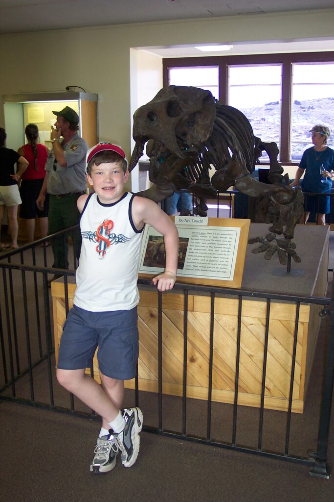
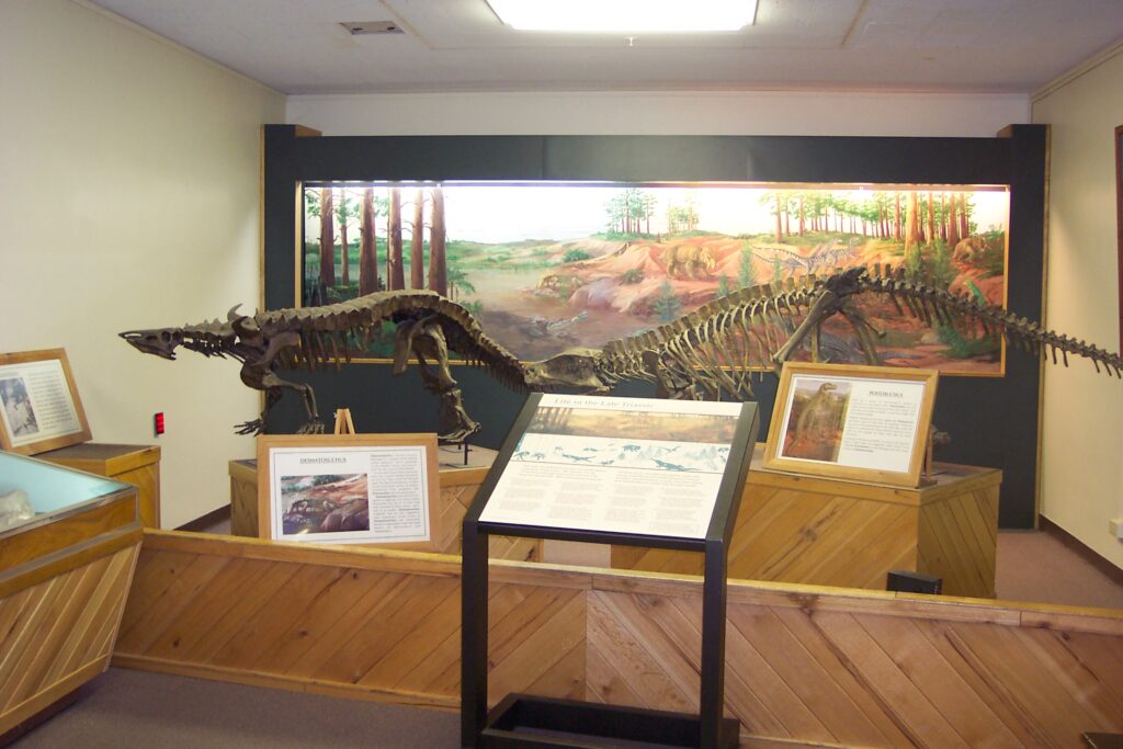
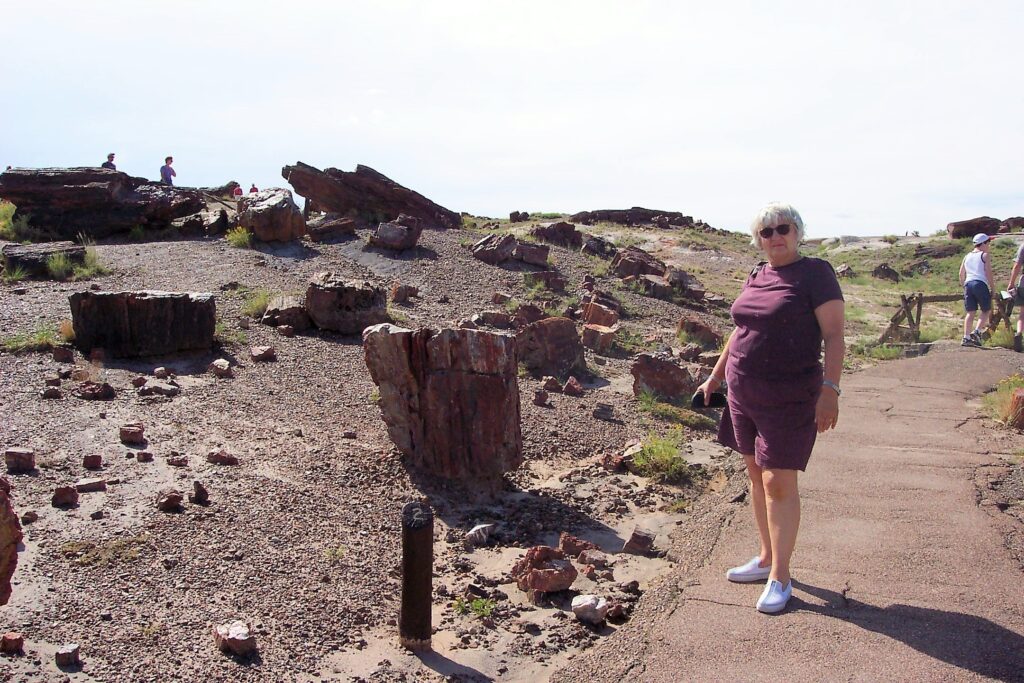
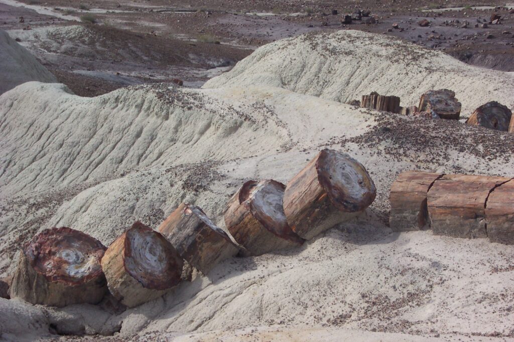
A single roadway winds through Petrified National Park, providing several photogenic pullouts, exhibits, archaeological sites and short hiking trails. We started at the Rainbow Forest Museum and Visitor Center. Inside the stone building there is a nice collection of books, information and monster skeletons. Here’s where visitors get their first glimpse of some of the giant reptiles and early dinosaurs that once prowled this humid swamp. There are many samples of the petrified rocks that we would see along the trails. We were told, if we wanted a souvenir, buy it here, because it is illegal to take any from the forest.
We watched a short film, which explained the petrification process and gave us insight to the array of fossils that are still being dug up in the park. We then took a walk along the short .3-mile Giant Logs Trail. It weaves through an assortment of the largest logs in the park, including “Old Faithful,” 35 feet long and weighing 44 tons. There were many information panels here as well. And again, Mary read everyone. She was a wealth of knowledge afterwards as we talked about both beautiful parks.
There were many logs that Mary and Maria thought would look great in either of our gardens. Needless to say, we sadly obeyed the law. We were a little sorry we didn’t buy some of the rocks back at the Visitor center. Although they were gorgeous, the cost was a bit discouraging.
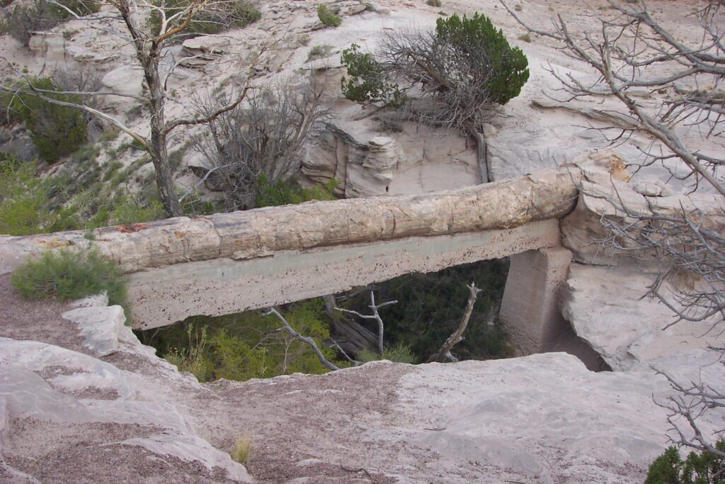
Agate Bridge features sweeping views and a 110 foot long petrified log bridge spanning a gully. Originally, the massive petrified log sat on the ground, but centuries of flood waters and erosion washed out the gully beneath the petrified log to form a natural agate bridge. That would have been amazing to see! It has since been reinforced wit
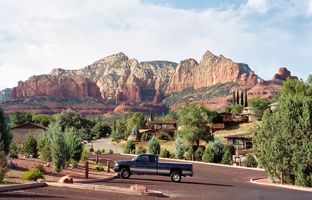
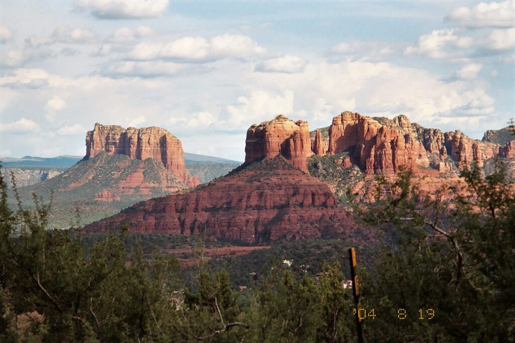
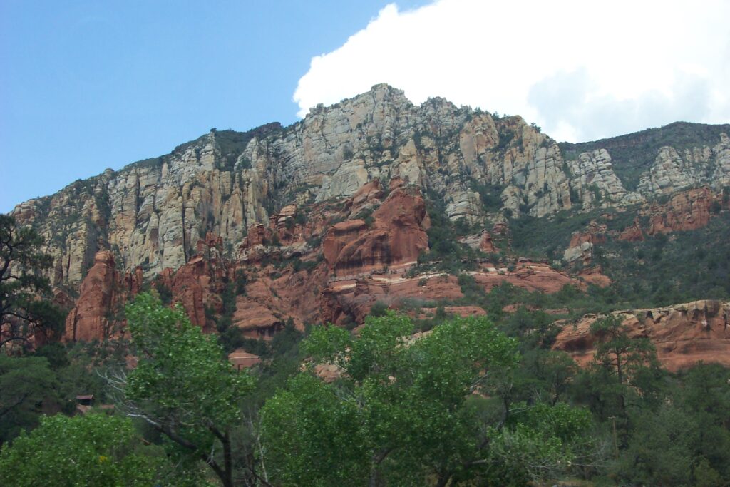
Sedona
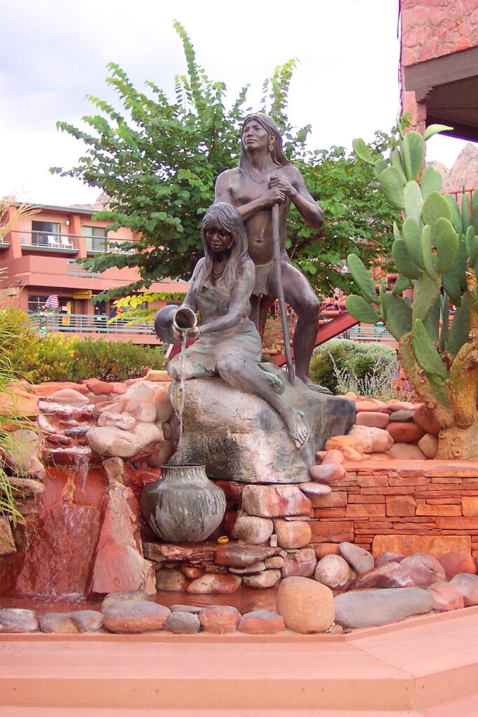
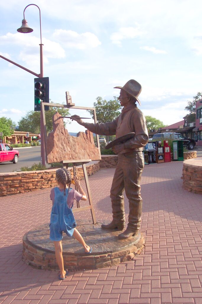
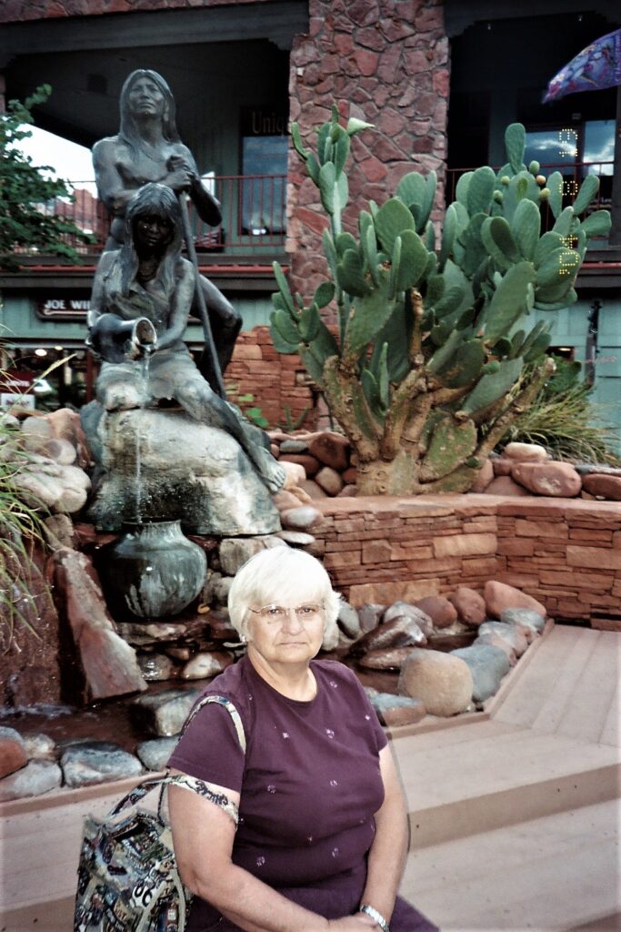
Sedona is one of the most visually stunning destinations in the United States. The area is known as a spiritual center with a number of energy vortexes in the surrounding hills and valleys. We used another time share and spent a few days in this area so we could take in many of the sights. We spent our first afternoon and evening in the old part of town where there are restaurants, tourist shops, galleries, and boutiques. Sedona is known for having a wide variety of unique foods, including rattlesnake and cactus.
A couple of Maria’s favorite sights were Red Rock Scenic Byway and Cathedral Rock. Red Rock Scenic Byway is your introduction to Sedona’s gorgeous Red Rock Country. It’s also an All-American Road, a designation reserved only for the most scenic of byways. The main 7-mile stretch is between Sedona and the Village of Oak Creek and passes by impressive red rock sandstone formations which look like they are on fire when the sun begins to set. Cathedral Rock is the most photographed site in the Sedona area. You can climb the rock if adventurous. Jake would have loved to, but the rest of us were content just seeing it.
On a less gleeful note: Maria had been to Sedona on a couple of occasions. She was shocked and a little disappointed to see how much of the surrounding area had started to be developed. It seemed to take away from the natural beauty of the area.
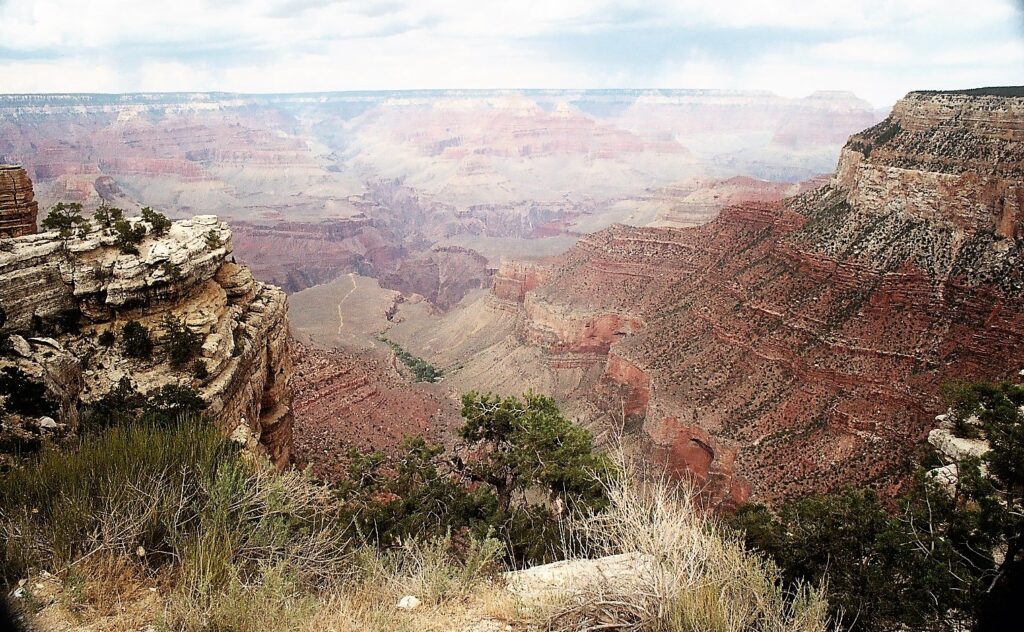
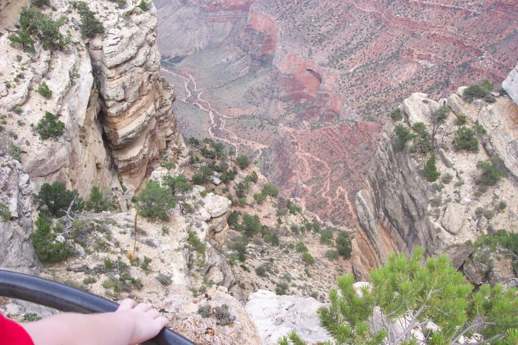
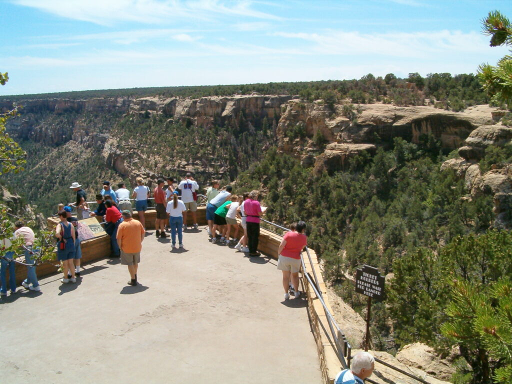
Grand Canyon
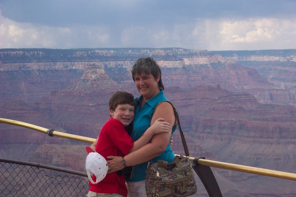
One of our three days in Sedona, we took a trip north to see the Grand Canyon. The weather forecast was not great, but when on vacation, Maria seems to have good weather follow her, or in this case stay with her. We set out for the Grand Canyon, driving through some real rough weather, but we remained optimistic. We got there just around lunch time, so we were all hungry. We got our tickets and decided to stop and eat at the cafe. While we were eating it was pouring rain and many people were leaving.
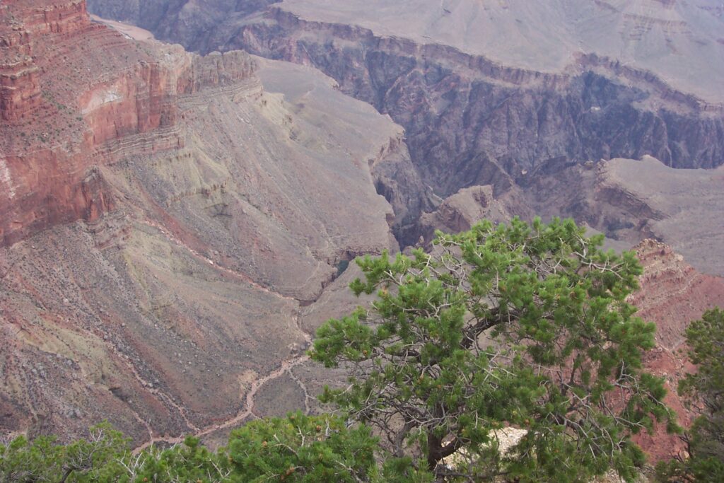
As we finished our meal, the rain took a break and the sun tried to peek out of the very dark clouds. We hopped on the uncrowded tour bus and started our visit to the first stop. We spent some time taking in the views and snapping pictures. The wind started to pick up and it got very chilly. We walked back to the bus pick up point and hopped on the bus heading to the next lookout point. As we boarded the bus we saw everyone was in rain gear, had umbrellas and were wet. We didn’t think too much of it at the time. We got off at the next point and again enjoyed the views. We even took a short hike along one of the edge trails. It was beginning to get overcast and the wind was picking up again. In the direction from where we came, it was getting very dark and you could see a storm brewing. We headed back to the bus stop. Once again, as we boarded we could see that everyone was wet, more so than the last time. We were glad that we seemed to be staying ahead of the rain.
Well, to make a very long story a bit shorter…. We visited every stop along the south rim trail and every time we boarded the bus, the people on the bus were wetter than previous ones, while we stayed perfectly dry. Once we encountered extremely strong winds where we had to hold onto our hats and felt the bitter coldness go through our jackets, but we were dry. We got several stares from people as the tour ended and we arrived back at the visitor center. Many people asked if we hid inside somewhere. They were very surprised to here we were enjoying every stop in dry weather. Apparently there was a monsoon rain storm that day. It just followed us around the rim but never reached us. Maria, said “this is how God provides her with such good vacation weather”.
As we arrived back at our time share in Sedona, the entire area was flooded and had fallen trees and debris everywhere. There was a hurricane like storm that went through with tornado type winds. We missed all of the fun that day. Thank you Lord.
By next morning the weather was back in the 80’s with bright sunny skies as we continued our visit in Sedona. The time-share resort maintenance worked through the night and had everything cleaned up. We did mini-golf, swimming, shopping and just plain resting up for our next adventures.
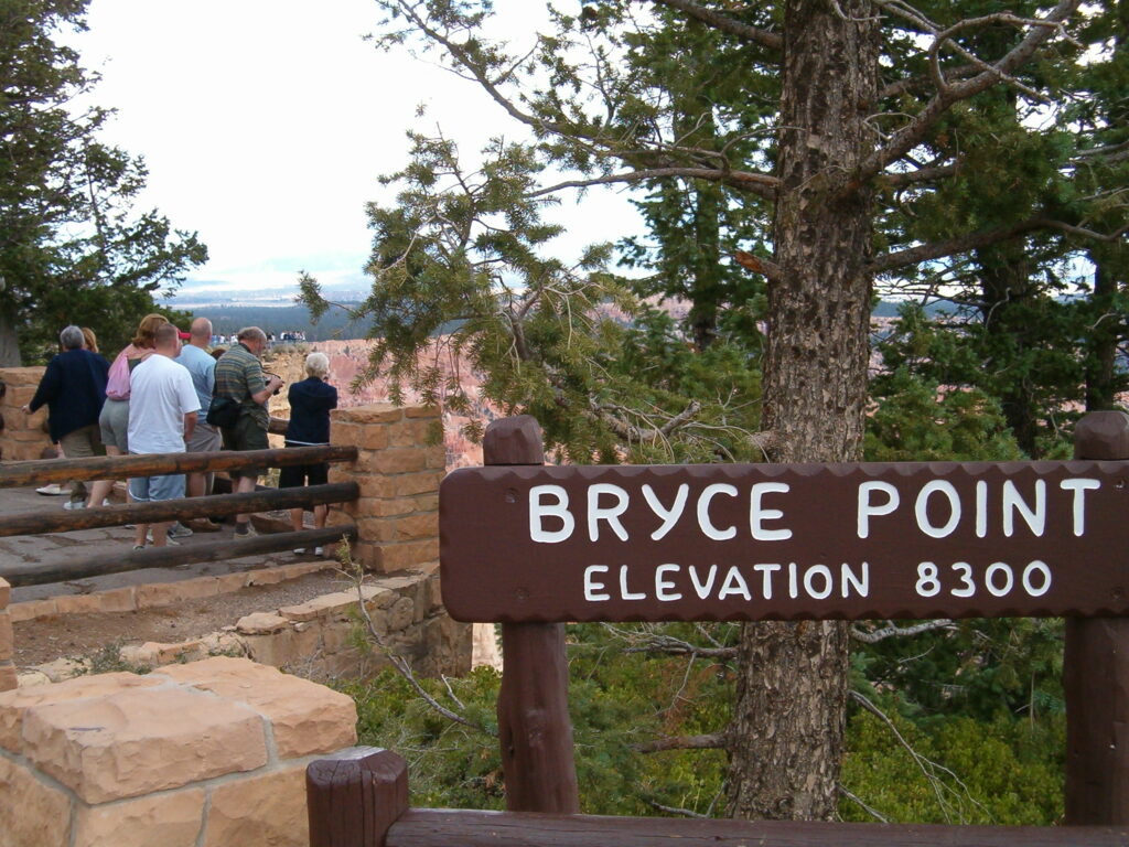
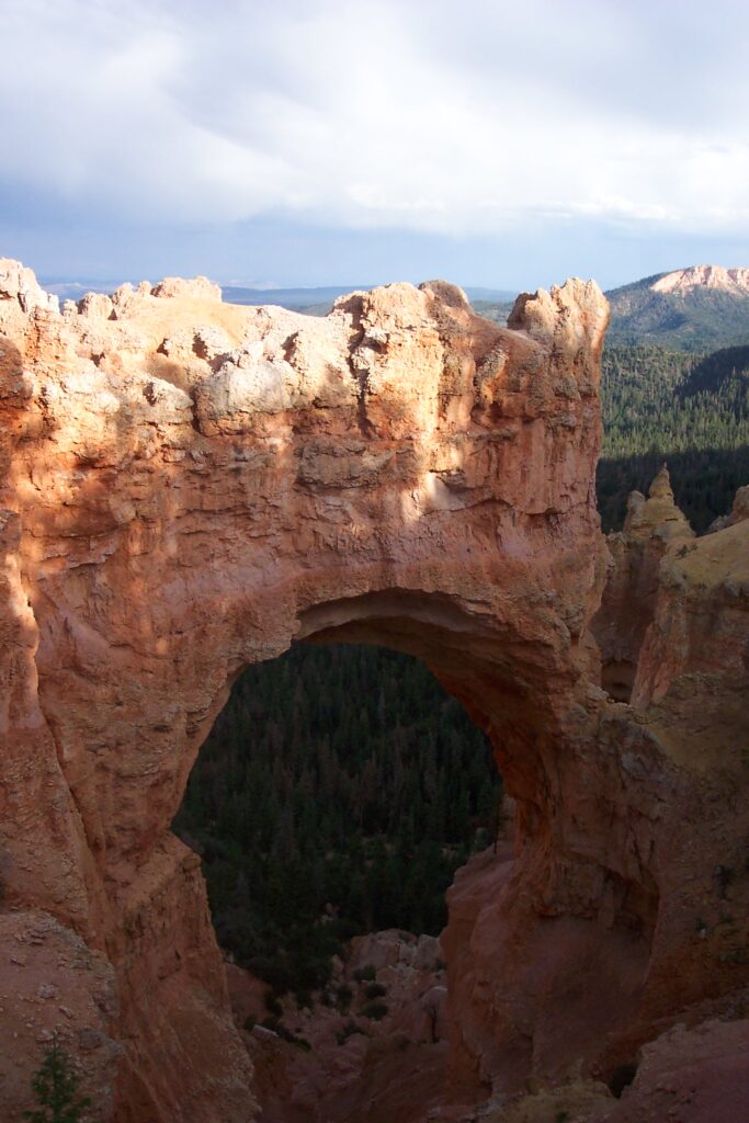
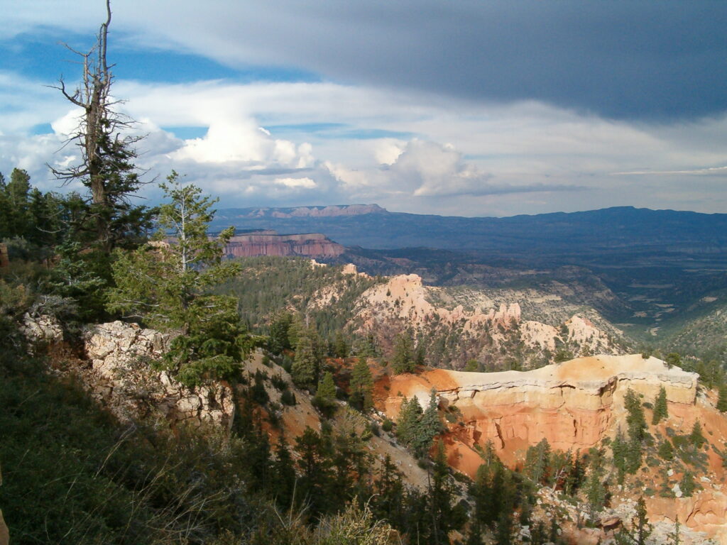
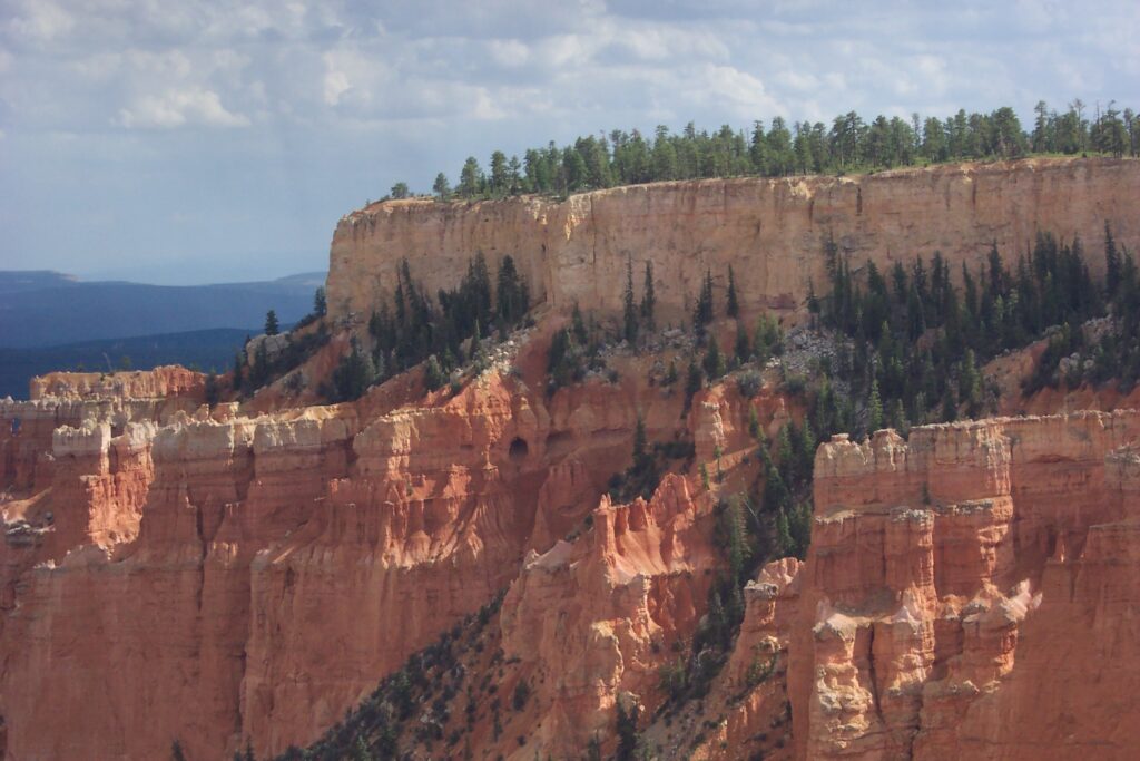
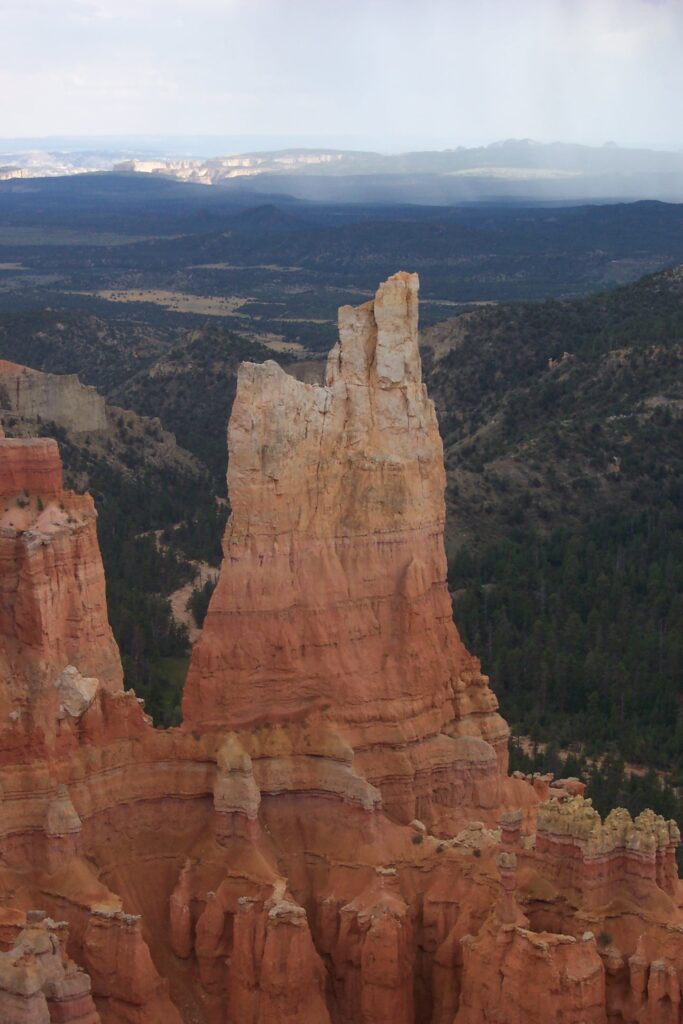
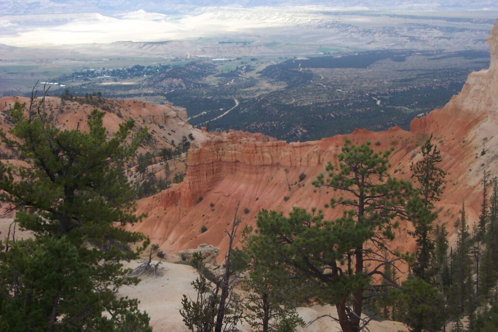
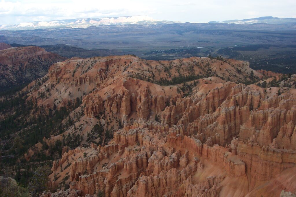
Bryce Canyon
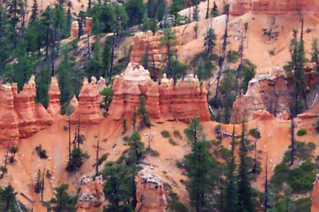
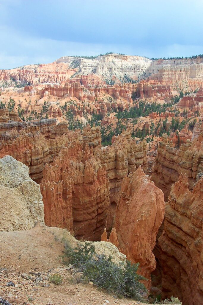
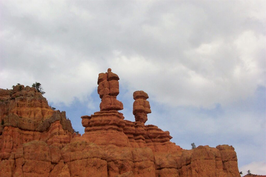
Bryce Canyon is not a single canyon, but a series of natural amphitheaters or bowls, carved into the edge of a high plateau with its red rocks, pink cliffs, and endless vistas of hoodoos (irregular columns of rock). Hoodoos exist on every continent, but here is the largest concentration found anywhere on Earth. The most famous of these is the Bryce Amphitheater, which is filled with irregularly eroded spires of these rock formations,
We walked the Rim trail which gives you views to most of the famous sites in the park: Bryce Amphitheater, Natural Bridge and Inspiration Point. Photo opportunities are excellent in every area..
Bryce Canyon at night is a whole new experience. There are several exciting activities available for the spirited at heart. During full moons, (1-2 consecutive nights each month), when the mix of shadows and moonlight cause the hoodoos to take on spooky personalities, Bryce Canyon offers guided moon hikes (no flashlights allowed). The rest of the month, Bryce Canyon is the ultimate place to learn about and enjoy the splendor of the night sky. Far from any light pollution of civilization, Bryce Canyon is a sanctuary for natural darkness. The night sky at Bryce is so dark, they say, on a moonless night, the Milky Way extends from horizon to horizon like a vast silver rainbow and the planets glow brightly in the sky and thousands of stars illuminate the night. There are several Ranger guided programs to help you experience these wonders. Unfortunately, we did not know about these at the time of our trip, so we did not get to enjoy any. Another for the list.
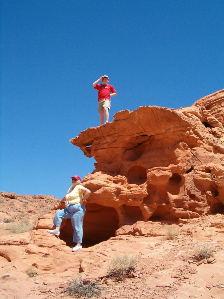
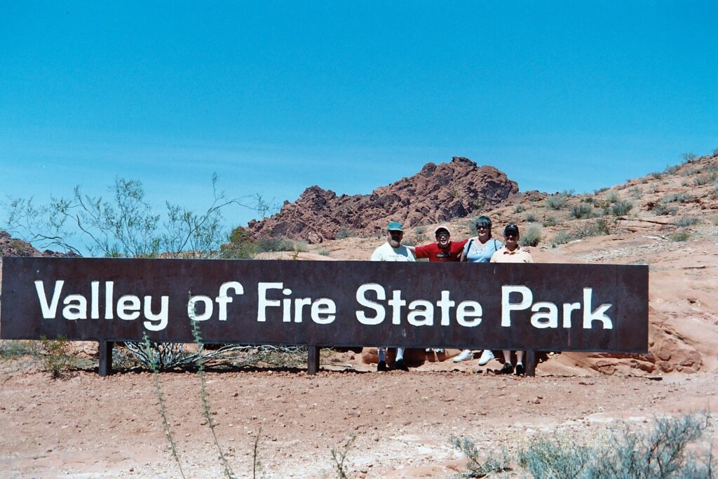
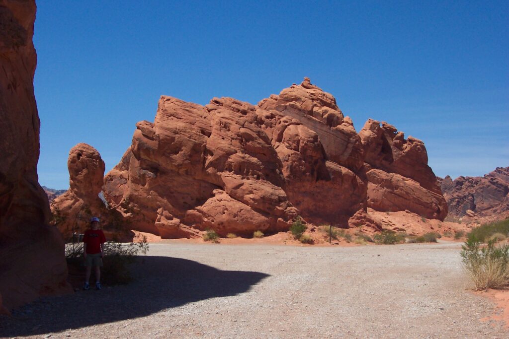
Valley of Fire
The Valley of Fire is Nevada’s oldest and largest state park, crowned in 1935. It was named a National Natural Landmark in 1968. Before it became a state park, a road was built through the valley as part of the Arrowhead Trail to connect Salt Lake City and Los Angeles. In the 1920s, the “Valley of Fire” was named by a AAA official who was traveling the road at sunset, when the sun shining on these rock formations give the allusion of them being on fire. He reportedly explained that the entire region looked like it was on fire.
This park is located in the Mojave Desert, 50 miles northeast of Las Vegas, Nevada. Its 40,000+ acres, consists of bright red and pink Aztec sandstone outcrops with white domes that are nestled in gray and tan limestone mountains. One of the best things about the Valley of Fire State Park is that you don’t have to be a hiker to enjoy it. Many of the most beautiful sights in the park can be seen right from the roads. But, depending on if you stay on the paved road or venture off, like we did, the road can be very rough with a variety of size rocks to dodge. It was worth the adventure.
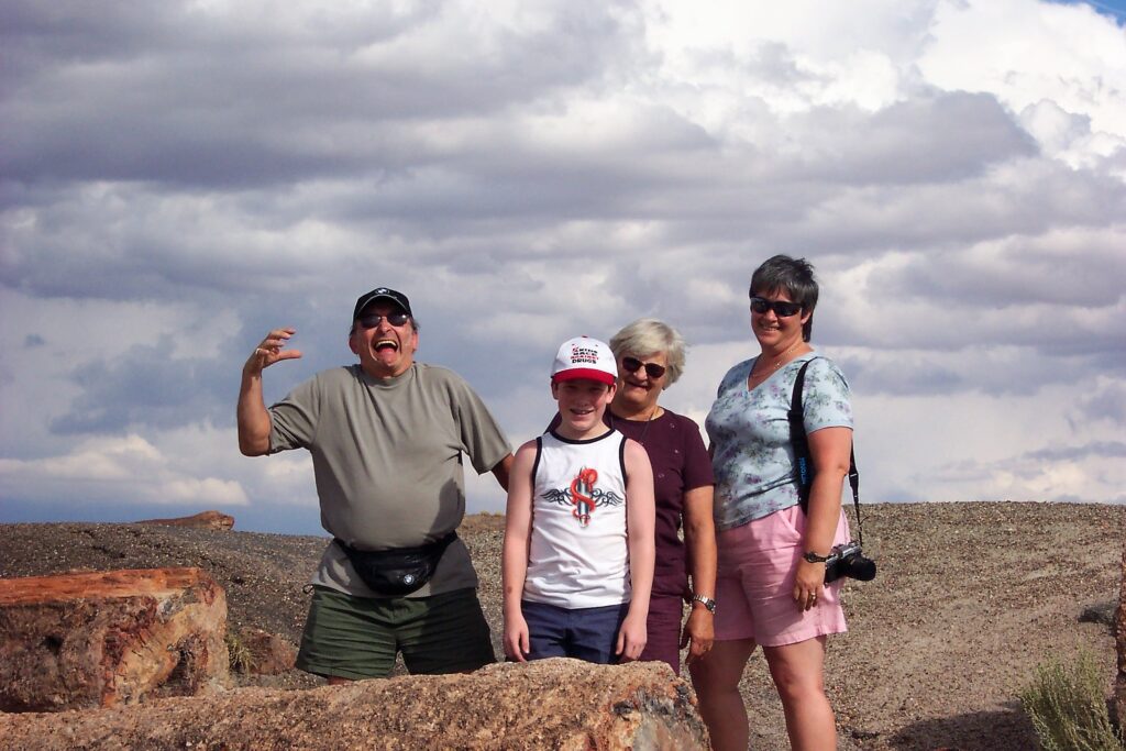
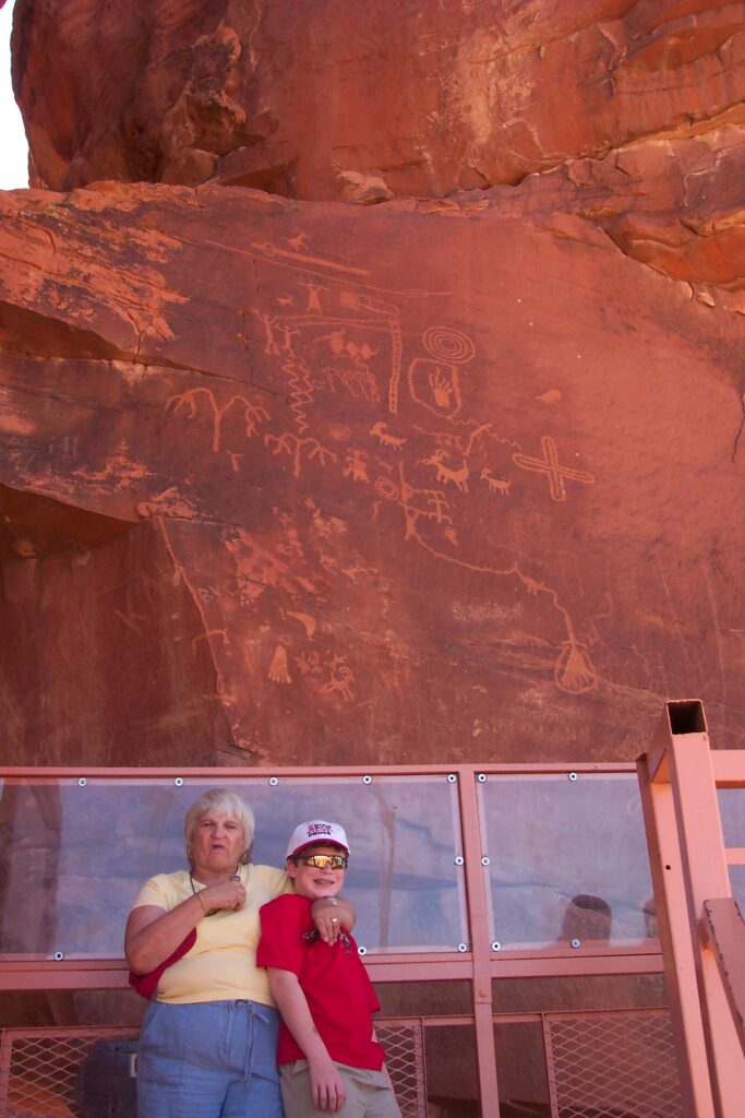
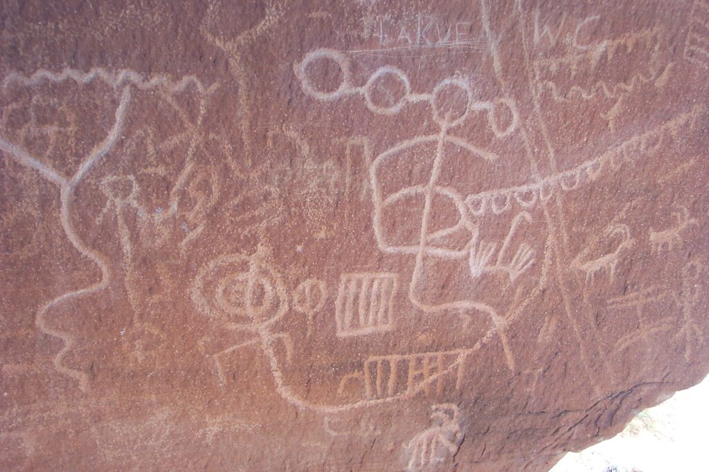
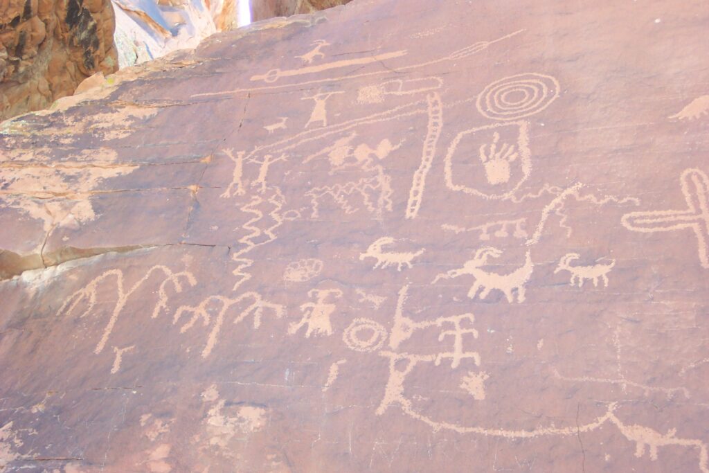
This was not on our original itinerary. Maria remembered seeing this on another Las Vegas trip. So, when we saw this on the map as a path from Bryce Canyon to Las Vegas, we had to stop. It was the perfect time of day, early evening, so the park was starting to catch fire. We all enjoyed it, in spite of the road. Mary was happy to see the 2000 year old petroglyphs and Jake was happy to run around and climb as much as he wanted.
Several movies were filmed here, including Total Recall, Viva Las Vegas, The Professionals, and Star Trek Generations.
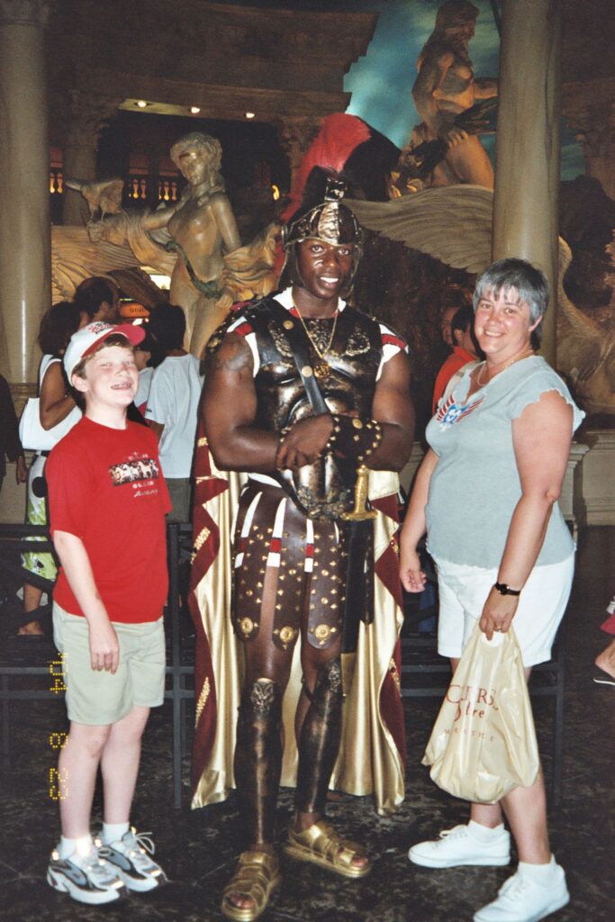
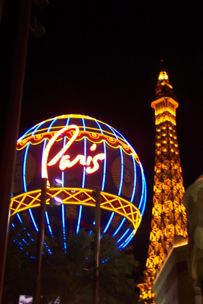
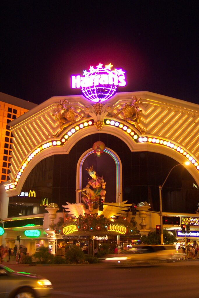
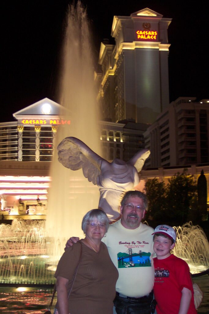
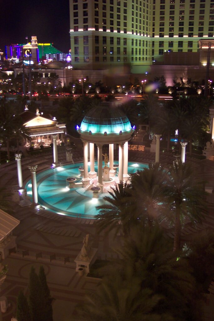
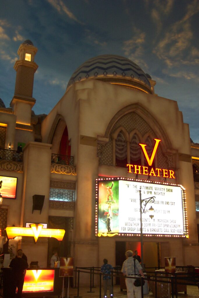
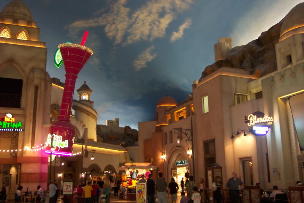
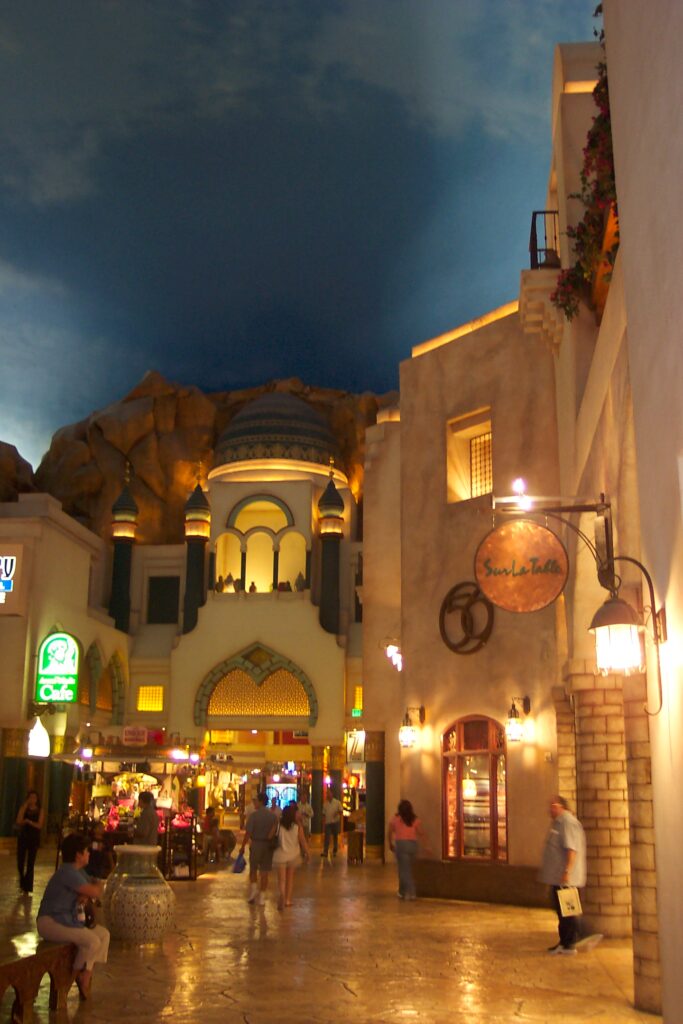
Las Vegas
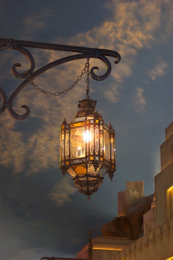
We arrived in Las Vegas at night and the entire town was lit up as expected. Vegas was going through it remodeling/reinventing state. The old massive casinos of the early to mid-late 1900s, which catered mostly to gamblers with a limited choice of shows, were getting torn down. New elaborate and much larger scale casinos, which catered to all ages (including families) were being built. These casinos had over-the-top themes with indoor shopping centers that made you feel like you were outdoors in another country, magnificent water shows (inside and out), playgrounds, amusement rides, arcades, huge swimming pools (the likes of Hurst’s Castle or Caesar’s), and variety shows abound. It was quite the transformation.
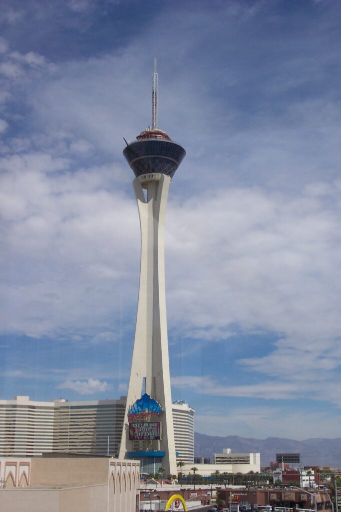
We spent most of our time there, moving from one casino to another to take in and admire their themes and decorating approaches and to catch their outdoor shows. All of us agreed the Taj Mahal’s underground area and Bellagio’s Water show were our favorites. Mary and Sonny did some gambling, while the 3 of us took in more of the casino sights. Jake got to ride a few of the amusement rides at Circus Circus and play some of their carnival and video games. Some of the most extreme amusement rides are at the Stratosphere. One such ride puts you in a rollercoaster style car and the track literally hangs off the side of the building. It moves the car back and forth on the track as the track see-saws up an down. You slide on the track and then hang over the track as it faces over 45 degrees downward towards the street. Did I say you are over 1000 feet in the air. No thank you, and we all agreed to this as a no do.
Las Vegas is a new place and a destination that you should visit, if you get an opportunity.
City underground, including the sky ceiling. It is an amazing place!
Hoover Dam
During one of our days in Las Vegas, we took a side trip to Hoover Dam (37 miles). Hoover Dam is a concrete arch-gravity dam (i.e. holds back water by using only the weight of the material and its resistance against the foundation to oppose the horizontal pressure of water pushing against it) in the Black Canyon of the Colorado River. It borders between the U.S. states of Nevada and Arizona. In fact, there is a sign which indicates the time-zone change as you go across the dam. It was constructed between 1931 and 1936 during the Great Depression, and was dedicated on September 30, 1935, by President Franklin D. Roosevelt, who named it Boulder Dam. Congress renamed it in 1947 to Hoover Dam. This Dam has been a story of innovation, success and conflict since its inception and still is today. It definitely played a major part in the growth of the west and its farming capabilities. If you are interested, here is its history,
Maria had visited this dam several times, once with her parents and other times with friends, all prior to 9/11. During these visits, she was able to tour the entire Dam, including the basin where they could walk out along the engineer paths at the bottom of the dam. She remembers taking a picture of her dad standing on the Nevada side just staring up at the magnitude of the dam. Well, things changed a lot after 9/11. Security tightened and many of our National landmarks and parks started to have restricted areas, including here. They built a visitor center on the Nevada side across from the Dam. This is where you now enter and purchase your tickets and can get drinks/snacks and souvenirs. The tour is much shorter and you don’t get to see much of the inter-workings of the dam, nor can you walk along the base. Each tour group starts from the visitor center and walks up to the top of the dam, where you catch the elevator to the engine room. There we spent most of the tour listening to how things work. Maria was sad that she couldn’t share her full experiences with us and Jake. However, the tour was still interesting and it looks like since we visited, they have added back the tunnel experience.
While we were there, they had started construction on the Dam bypass which stretches across the river down-stream from the dam, at the top of the mountain sides. It was much needed, as with all of the security, the small one-lane road that led down and pass the Dam was over crowded and traffic would be backed up for hours. This is now a new multi-lane access route between states, and you can exit on the Nevada side to get to the Visitor Center.


That concludes our very exciting trip. It was an inspiration to our 40th anniversary trip we took in our sidecar, in 2008.
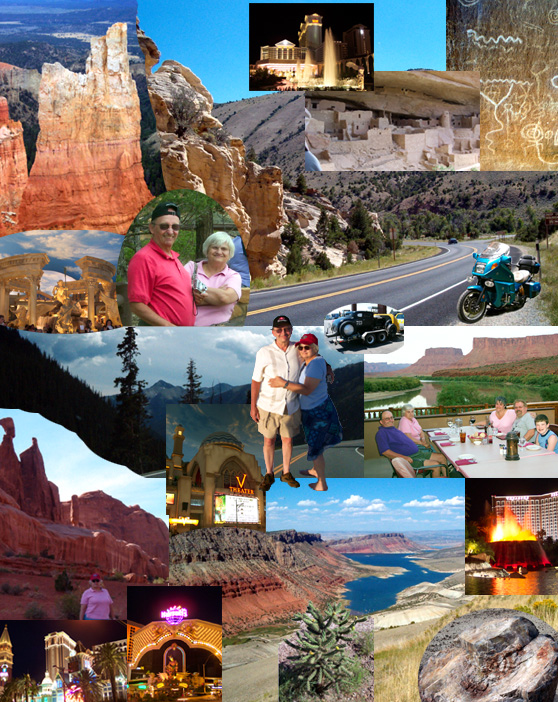
Maria made this collage for us. Notice anything out of the ordinary?